US Air Force SBRIS GEO Flight 3 Satellite Successfully Launched
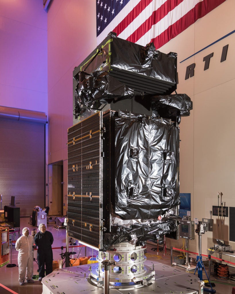
SBIRS GEO Flight 3 satellite. Photo: Lockheed Martin
[Via Satellite 01-23-2017] United Launch Alliance (ULA) successfully launched the U.S. Air Force’s Space Based Infrared System (SBIRS) Geostationary (GEO) Flight 3 satellite from Cape Canaveral Air Force Station in Florida on Jan. 20. The Lockheed Martin-built satellite began responding to commands as planned, approximately 37 minutes after lift-off, according to the company. SBIRS GEO Flight 3 is equipped with scanning and staring sensors that collect and transmit infrared surveillance information to ground stations. The U.S. military will use this information to detect missile launches, support ballistic missile defense, expand technical intelligence gathering, and bolster situational awareness on the battlefield.
This mission was launched aboard an Atlas 5 Evolved Expendable Launch Vehicle (EELV) 401 configuration vehicle, which includes a 4-meter diameter Large Payload Fairing (LPF). The Atlas 5 booster propulsion for this mission was powered by the RD AMROSS RD-180 engine, and the Centaur upper stage was powered by the Aerojet Rocketdyne RL10C engine. Aerojet Rocketdyne propulsion systems on the Atlas 5 include the RL10C-1 upper-stage engine, six helium pressurization tanks, and 12 Centaur upper-stage Reaction Control System (RCS) thrusters; also, Aerojet Rocketdyne provided 18 monopropellant hydrazine thrusters on the GEO Flight 3 satellite.
The satellite will begin transitioning to its final location in geosynchronous orbit, approximately 22,000 miles above the Earth. There, its solar arrays, light shade and antennas will be deployed to begin early on-orbit testing.
SBIRS GEO 1 and GEO 2, which were launched in 2011 and 2013 respectively, continue to meet performance expectations, according to a statement by Lockheed Martin. The satellites’ sensor pointing accuracy and sensitivity for detection of targets significantly exceed specifications. While SBIRS’ primary mission is strategic missile warning, infrared data will also be made available for new qualified military and civilian applications at the Air Force’s recently opened Tools, Applications and Processing Lab in Boulder, Colorado.
The next satellite, GEO Flight 4, will undergo final assembly, integration and test prior to its planned launch later this year. SBIRS GEO 5 and GEO 6, which are currently in production, incorporate a new common spacecraft bus, the modernized A2100, to dramatically reduce costs and cycle times while increasing the potential to incorporate future, modernized sensor suites.