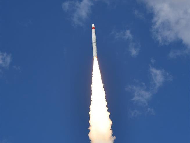
Five new remote-sensing satellites were launched on a Long March-11 rocket from the Jiuquan Satellite Launch Center in northwest China’s Gobi Desert on Thursday at 2:42 p.m. Beijing Time.
The satellites belong to the commercial remote-sensing satellite constellation project Zhuhai-1, which is comprised of 34 micro-nano satellites, including video, hyper-spectral, and high-resolution optical satellites, as well as radar and infrared satellites. The carrier rocket was developed by the China Academy of Launch Vehicle Technology, and the satellites were produced by the Harbin Institute of Technology and operated by the Zhuhai Orbita Aerospace Science and Technology.
The newly launched satellites comprise four hyper-spectral satellites with 256 wave-bands and a coverage width of 150 kilometers (km), and a video satellite with a resolution of 90 centimeters. The Zhuhai-1 hyper-spectral satellites have the highest spatial resolution and the largest coverage width of their type in China. The data will be used for precise quantitative analysis of vegetation, water and crops, and will provide services for building smart cities, said Orbita, the largest private operator of hyper-spectral satellites in orbit. The company aims to cooperate with government organizations and enterprises to expand the big data satellite services.