
Imagery and Sensing
-
 Imagery and Sensing
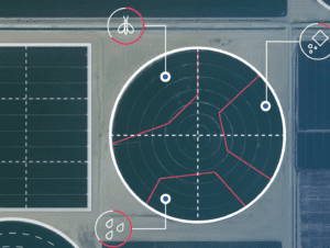
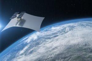
ICEYE Deploys Dark Vessel Detection
ICEYE has deployed its global Dark Vessel Detection solution for governmental maritime security customers, the company announced Monday. This solution combines synthetic-aperture radar (SAR) satellite data from ICEYE, and Automatic […]
-
 Connectivity
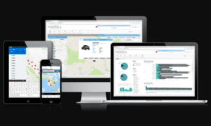
Farmers Edge, Fairfax Brasil to Bring Crop Insurance to Brazil
Farmers Edge and Fairfax Brasil have partnered to bring customized, data-driven crop insurance to growers in Brazil. This agreement connects the Farmers Edge risk management platform, powered by field-centric data […]
-
 Finance
CropX Acquires CropMetrics, Grows U.S. Precision Ag Footprint
CropX has acquired of Nebraska-based CropMetrics, a provider of cloud-based, precision-irrigation tools. Current CropMetrics and CropX partners and customers will now have access to the companies’ combination of in-soil data, […]
-
 Imagery and Sensing
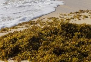
Globalstar Helps Researchers Track Mysterious Seaweed
Dutch researchers are using drifter buoys fitted with SPOT Trace satellite trackers from Globalstar Europe Satellite Services to understand the dramatic increase of Sargassum seaweed across the North Atlantic, Globalstar […]
-
 Finance
SkyWatch Raises $7.5M in Series A Financing Round
SkyWatch Space Applications, a Canadian space technology startup, has completed a $7.5 million Series A round of financing. SkyWatch aims to provide companies with affordable and reliable access to Earth […]
-
 Government/Military
Thales Alenia Space, Thales Sign French Defense Contract for Stratobus Type Platform
Thales Alenia Space and Thales have signed a contract with The French defense procurement agency DGA to carry out a concept study concerning intelligence, surveillance, and reconnaissance (ISR) applications using […]
-
 Government/Military
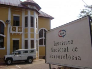
Mozambique Uses Chinese Satellite to Predict Natural Disasters
Mozambique’s National Institute of Meteorology (INAM) has begun using a satellite system provided by China, according to Xinhua. INAM announced on Friday that the new system will allow for more […]
-
 Finance
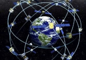
GPS Market to Reach $129B by 2025, Report Predicts
The global GPS market size is expected to reach $128.7 billion by 2025, according to a new report from KBV Research. This estimate shows a market growth of 20.3% CAGR […]
-
 Finance
Geoforce Plans to Acquire Trakopolis
Geoforce will acquire the assets of Trakopolis’ subsidiary Trakopolis SaaS. Based in Calgary, Alberta, Trakopolis SaaS provides global traceability solutions. Geoforce, which is headquartered in Plano, Texas, plans to integrate […]
-
 Imagery and Sensing
Astraea Releases EarthAI Notebook
Astraea has released EarthAI Notebook, a tool for analyzing geospatial data. The company says that EarthAI Notebook is a fully hosted and managed JuypterLab Notebook designed to analyze raster data […]
-
 Government/Military
NASA Selects ULA for GOES-T Mission
NASA has selected United Launch Alliance (ULA) to provide launch services for the Geostationary Operational Environmental Satellite-T (GOES-T) mission, the agency announced on Wednesday. The GOES-T mission aims to provide […]
-
Finance
Growers Edge, CropX Incentivize Farmers to Adopt Technology
Growers Edge announced a partnership with CropX on Tuesday, Dec. 17, that the companies say will reduce risk and sustainably improve yields for farm operations. The companies aim to develop […]
-
Imagery and Sensing
Collins Aerospace Joins GPS Innovation Alliance
Collins Aerospace has joined the GPS Innovation Alliance (GPSIA). The aerospace and defense products supplier joins founding-member companies John Deere, Garmin and Trimble as well as 11 national organizations in […]
-
Imagery and Sensing
Farmers Edge Offers Satellite Imagery for Specialty Crops
Farmers Edge is now offering satellite imagery and mapping technology for specialty crops. Growers gain access to FarmCommand, an integrated farm data management platform that includes a set of imagery-derived […]
-
 Government/Military
Capella Space Becomes First Commercial SAR Provider to Work With NRO
Capella Space, which provides Earth observation imagery, has signed a contract with the National Reconnaissance Office (NRO), to study the integration of its Synthetic Aperture Radar (SAR) imagery into the […]
-
 Imagery and Sensing
CropX Forms Major Precision Agriculture Partnership in Central America
Agricultural analytics company CropX has partnered with Costa Rican agroforestry equipment vendor FarmAgro to provide satellite-powered precision agriculture tools to farmers in Central America. The partners will deploy applications such […]
-
 Imagery and Sensing
MyRadar Launches Aircraft Tracking Satellite
Acme AtronOmatic, the makers of the MyRadar Weather Radar app, have launched a non-commercial, experimental communications satellite aboard Rocket Lab’s Electron rocket with launch provider Alba Orbital. The launch event, […]
-
Imagery and Sensing
Protecting GPS Means Maintaining the “1 Decibel” Standard
The fundamentals of spectrum policy can be complicated and confusing, and, as the need for spectrum increases, it’s more important than ever to understand how and why our communication and […]
-
 Imagery and Sensing
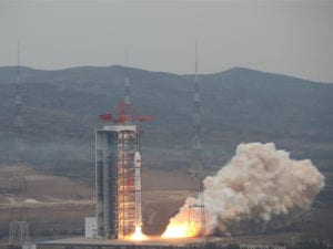
China Launches 27th Satellite of 2019
China successfully launched a new weather radar-imaging satellite designed for civilian use, Chinese state media confirmed. Gaofen 12, the latest in a fleet of Chinese Earth observation satellites, lifted off […]
-
Government/Military
Capella Space Wins US Air Force SAR Contract
Capella Space was awarded a contract with the U.S. Air Force to apply Synthetic Aperture Radar (SAR) data to the military branch’s virtual reality software for the purpose of simulating […]
-
 Imagery and Sensing
Mother Nature Will Not be Denied: Hurricanes and the Future of Space Flight
As Floridians on the east coast of the U.S. flooded grocery stores for water and food in preparation for the oncoming storm, Hurricane Dorian grew swiftly from a manageable Category […]
-
 Finance
BlackSky Receives $50 Million in Funding from Intelsat
BlackSky, a provider of geospatial intelligence, satellite imaging, and global monitoring services, secured a $50 million senior secured loan from Intelsat. The transaction results in an industry first, creating a […]
-
 Finance
Orbital Insights Receives $50 Million in Series D Financing
Orbital Insight completed a $50 million Series D financing. The funding round was co-led by Sequoia Capital and Clearvision Ventures, with participation from new investors Invicta Growth, Bunge Ventures, Chevron […]
-
 Imagery and Sensing
Leaf Space Signs On as Pixxel’s Partner on the Ground
Italian microsatellite ground segment company Leaf Space has reached an agreement with Pixxel to support the Earth imagery startup’s first 24 satellites, set to launch in July. Pixxel designed its […]
-
 Finance
Ursa Secures $15 Million in Series B Funding
Ursa secured $15 million in Series B funding led by Razor’s Edge Ventures. The Series B financing was joined by strategic investors Citi, New York Ventures, a division of Empire State […]
-
 Imagery and Sensing
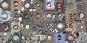
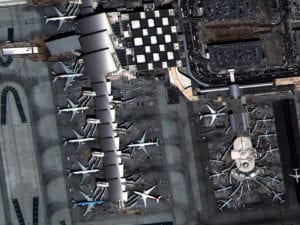
Iceye, RS Metrics Provide Global Iron Ore Stockpile Monitoring
Iceye signed a Memorandum of Understanding (MOU) with RS Metrics to jointly offer to the commodities market the world’s first global Synthetic Aperture Radar (SAR)-based iron ore inventories dataset with […]
-
 Imagery and Sensing
Soar Partners With China Siwei on Satellite Imagery
Digital mapping and imagery company Soar revealed a strategic partnership with the China Siwei Surveying and Mapping Technology, a part of China Aerospace Science and Technology Corporation (CASC). Soar, which […]
-
 Imagery and Sensing
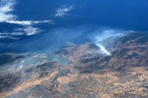
California Fires Imaged From ISS and Satellites
From the ground, the scenes of California’s wildfires are terrifying, but looking down from high above reveals the massive and horrific scale of the blazes. The International Space Station and […]
-
 Imagery and Sensing
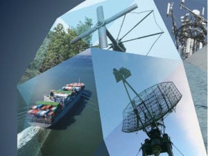
HawkEye 360 Expands Into UHF and L-Band
HawkEye 360 revealed that its RFGeo product can now map an expanded catalog of signals, aiming to address new markets such as border security or anti-poaching efforts. RFGeo identifies and […]
-
 Government/Military
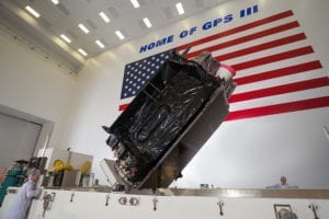
GPS III Contingency Operations Program Nears Operational Acceptance
The GPS III Contingency Operations Program (COps) successfully connected with the first GPS III satellite on orbit. The COps system will allow the U.S. Air Force to operationally command and […]