To be successful, a satellite service must be competitive with a terrestrial alternative if one is available. The level of service must equal or exceed the terrestrial service at a comparable cost if the satellite solution is to gain acceptance among potential customers.
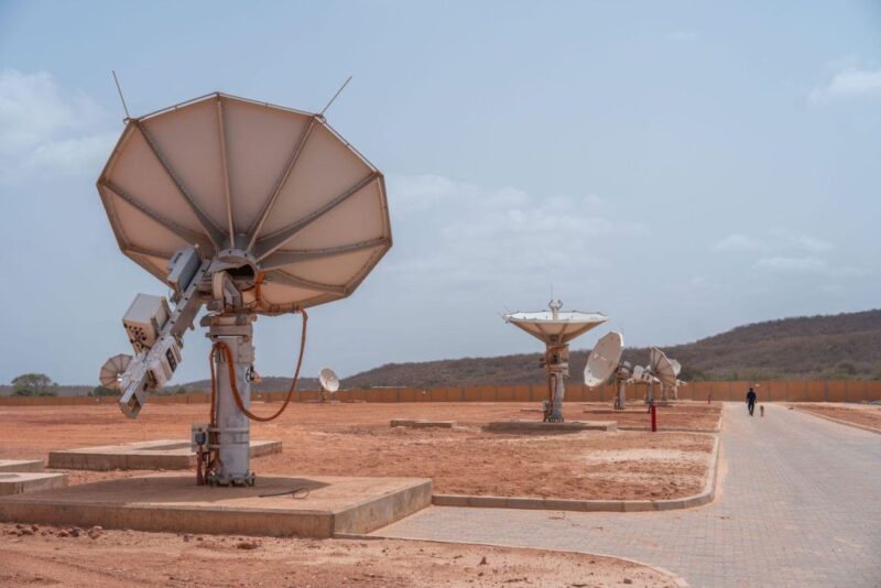
When there are two alternatives, the choice of a satellite system will involve considerations of cost, the amount of user equipment, ease of use and reliability. For example, a potential broadband customer would have an expectation of an affordable subscription rate, convenient installation, superior performance and high availability. One of the factors that affects availability in a satellite communication link is rain.
The presence of rain can have a significant detrimental effect on the propagation of an electromagnetic signal. The rain degradation increases as the frequency increases. At C- band (6/4 GHz), rain has little effect, except for brief periods of unusually heavy rain, but at Ku-band (14/12 GHz) it can be important. Nevertheless, typical rain margins on the order of 7 dB can be allocated to accommodate rain loss at Ku-band in most geographic regions to ensure availability comparable to that of C-band. At higher frequencies in Ka-band (30/20 GHz), rain can have a very large effect that simply cannot be overcome at the usual levels of availability. The result is that the availability will be reduced. This fact must be taken into consideration when designing a Ka-band satellite system to provide a service that will be widely used and accepted.
Attenuation Issues
The principal effect of rain is attenuation. A passing electromagnetic wave gives up energy to the liquid in a raindrop. The loosely bound molecules of water absorb energy from the electromagnetic wave, which in effect slightly heats the raindrop. Water in solid form, such as snow or ice, produces no attenuation, as the molecules of the crystals are tightly bound together and do not resonate with the passing wave.
The amount of attenuation increases as the density of the rain increases and as the wavelength of the electromagnetic wave approaches the size of a typical raindrop. The wavelength is equal to the speed of light (3 x 10⁸ m/s) divided by the frequency, while the average diameter of a raindrop is about 1.5 mm. At the downlink C-band frequency of 4 GHz, the wavelength is 75 mm. Thus the wavelength is 50 times the average diameter of a raindrop and the waves pass through the rain virtually without interaction.
At the Ku-band downlink frequency of 12 GHz, the wavelength is 25 mm. Here the ratio of wavelength to raindrop diameter is still fairly large, but yet is one-third the value at C-band. Consequently, there is an interaction that can result in a noticeable absorption of energy. The received carrier power will decrease and the bit error rate of a digital signal will increase. Direct broadcast television customers in Florida are familiar with the degradation or loss of picture during a heavy rainstorm, which can be detected on the television long before the storm actually arrives.
At the Ka-band downlink frequency of 20 GHz, the wavelength is 15 mm. At this frequency, the wavelength is only 10 times the size of a raindrop. Therefore, there is a significant exchange of energy between the passing electromagnetic waves and the rain and a corresponding significant attenuation of the satellite signal. As the wavelength approaches 1.5 mm, the attenuation continues to increase and theoretically becomes maximum at a frequency of 200 GHz.
Figure 1 on page 26 shows how the specific attenuation, or attenuation per kilometer, varies with rain rate and frequency. The rain rate is a measure of the number of raindrops per unit volume. A rain rate of 25 mm/h would correspond approximately to an availability of 99.95 percent in Washington, DC. For this rain rate, the specific attenuation at 4 GHz is only 0.02 dB/km. Thus assuming a typical effective path length of 5 km through the rain layer, the attenuation is 0.1 dB, which is negligible. However, for the same rain rate at 12 GHz the specific attenuation is 1.0 dB and the total attenuation is roughly 5 dB. Consequently, the received carrier power would be less than one-third what it would be with a clear sky. The link budget would have to accommodate a rain loss of this magnitude.
At 20 GHz, the specific attenuation is somewhat less than 3 dB/km and the total attenuation is roughly 12 dB, or more than a factor of 15. A margin of this magnitude would be impractical. If a more reasonable margin of about 7 dB were allocated, then according to the graph, the maximum allowable rain rate at 20 GHz would be reduced to around 15 mm/h. This implies that the received signal strength would be maintained at the necessary level for a smaller percentage of rainfall situations.
System Temperature
The second mechanism for rain degradation is an increase in system temperature. The system temperature is a measure of the total noise in the receiver. Just as the thermodynamic temperature of the air is a macroscopic measure of the average kinetic energy of the air molecules on the microscopic scale, the system temperature is a measure of the average energy of electrons moving randomly within the receiver. The system temperature at the output terminals of an antenna is equal to the antenna noise temperature plus the equivalent temperature of the chain of components in the receiver, including the low noise amplifier (LNA), the downconverter and other elements. The key parameter that describes the receive antenna is the so-called "figure of merit," or ratio of antenna gain to system temperature G/T.
On the downlink, the clear sky noise temperature of an earth station antenna is roughly 25 K. If a typical receiver equivalent temperature is about 125 K, the overall clear sky system temperature for a small antenna might be approximately 150 K. When it rains however, the antenna sees the warm rain at a temperature of 300 K. Thus the overall system temperature increases. This increase in system temperature can cause a degradation in G/T that is of the same order of magnitude as the rain attenuation itself.
On the uplink, the satellite antenna is directed toward a large area of the warm Earth and has a noise temperature of 300 K anyway. The total system temperature of a satellite receiver might be about 700 K. Thus the uplink is affected only by attenuation, which is higher than the downlink attenuation because of the higher frequency.
Polarization Issues
In addition to attenuation, rain affects the polarization of satellite signals. There are two forms of polarization: linear and circular. For linear polarization, the electric field in a signal transmitted from a satellite may oscillate either in a vertical direction or in a horizontal direction relative to the equatorial plane. For circular polarization, the electric field rotates in either the clockwise or counterclockwise directions. The purpose of using either two linear or two circular polarizations is to double the data rate capacity permitted within a given bandwidth. It should be noted that, as seen from the earth station, the vertical and horizontal linear polarizations are not only both rotated with respect to the local horizon, but they are also not precisely orthogonal (unless the earth station is at the same longitude as the satellite).
The source of rain degradation is the change in polarization angle. A falling raindrop is not spherical. Rather, the viscous forces of the air cause it to be flattened into an oblate spheroid. The orientation of the axis of the raindrop is in general not vertical, but has a statistical distribution with an average cant angle of about 25 degrees. Consequently, the transmission path through the raindrop is different for different polarizations and the polarization of the received signal is altered. For a fixed LNA orientation, the polarization mismatch results in a loss on the order of a few tenths of a dB. Thus, this loss is small but measurable. Some antennas can automatically maintain the proper polarization alignment.
Availability
A geographic area is divided into rain climate regions characterized by the probability of a given rain rate being exceeded. The rain regions for the United States are illustrated in Figure 2 on page 26. For example, Washington, New York and Chicago are in region D2 and Miami is in region E. The significant quantity is the maximum rain rate, not the annual rainfall. Thus San Francisco and Seattle are both in region C, which at first glance might seem paradoxical. Although it may rain often in Seattle and much less frequently in San Francisco, the likelihood of it raining hard, however, is about the same in both cities.
The maximum rain rate, the frequency and the effective path length through the rain layer determine the rain loss. The effective path length is not a geometric length, but is rather a statistical quantity that is characterized by the manner in which the rain distribution data are taken into account in a particular model. The two authoritative models that are commonly used are the Crane model, developed by Robert Crane of the University of Oklahoma, and the ITU-R (formerly CCIR) model, created by a committee of the Radiocommunication Sector of the International Telecommunication Union. These models differ slightly by the boundaries of rain regions and the calculation of the effective path length. The basic Crane model, published in a journal of the Institute of Electrical and Electronics Engineers (IEEE) in 1980, is known as the global model. It has been enhanced by the two-component model, which takes into account the distinction between the core rain area and the fringe area within a rain cell. This model is described in Crane’s recent book, Electromagnetic Wave Propagation Through Rain (Wiley 1996). A comparison of rain degradation at the downlink frequencies of 4 GHz, 12 GHz, and 20 GHz for rain region D2 and rain region E and various availabilities is made in the Table on page 28 based on the Crane global model using software that accompanies the book.
For example, for an availability of 99.90 percent in region D2 (such as in Washington, DC), the maximum rain rate is 15.2 mm/h. This means that the probability of the specified rain rate being exceeded is 0.10 percent, corresponding to a total time of 8.77 hours per year that is divided into random increments occurring at random times. At the Ku-band downlink frequency of 12 GHz, the rain attenuation is 2.8 dB and the decrease in receive antenna figure of merit is 2.7 dB, implying a total degradation of 5.5 dB. In region E (such as in Miami), the total degradation is 11.6 dB, an increase of about 6 dB or a factor of four. To compensate for this loss, the diameter of the receive antenna would have to be doubled. For example, instead of the standard 45cm (18 inch) dish commonly used for direct broadcast television, the antenna size would have to be nearly 1 meter to maintain the same availability. Therefore, unless a larger antenna was used, the availability for the same rain loss would be reduced to 99.6 percent. This fact of nature explains the occasional dissatisfaction of DBS customers in Florida.
At Ka-band the rain problem is much worse. For a similar rain margin of 5.7 dB in region D2, the availability is reduced to 99.6 percent and in region E it is much less. With a higher margin of 8.4 dB, the availability in region D2 could be increased to 99.8 percent. The experimental Ka-band Advanced Communications Technology Satellite launched by NASA on the Space Shuttle STS-51 in September 1993 has contributed much to knowledge of rainfall propagation effects and has made possible many of the commercial Ka-band projects now in development.
Methods Of Mitigation
Rain loss at Ka-band can be mitigated, but it cannot be totally compensated. One technique is site diversity. Two earth stations separated by a distance of about 15 km to 30 km and connected by a terrestrial link can be used. It is unlikely that both earth stations would experience the same rain intensity simultaneously.
Another technique is to reserve bandwidth to permit more robust Forward Error Correction coding that will maintain the same bit error rate at the specified bit rate at a lower carrier power. In addition, the bit rate itself may be lowered below the nominal value during periods of heavy rain.
Another possibility is the selective allocation of an alternative frequency, such as Ku-band, as needed in areas encountering rain at a particular time. The rain degradation at Ku-band could be within the allocated margin even though the margin was exceeded at Ka-band.
Rain And Future Satellite Projects
The effects of rain can have a significant impact on satellite communication, especially at the relatively high frequencies of Ka-band now being considered for new satellite systems, such as broadband service. Among the many business considerations involved in the design of such systems, the availability in the presence of rain is an important issue in estimating customer acceptance. This issue is particularly important when there is a terrestrial alternative providing a similar service.
Robert A. Nelson is Via Satellite’s Technical Editor.