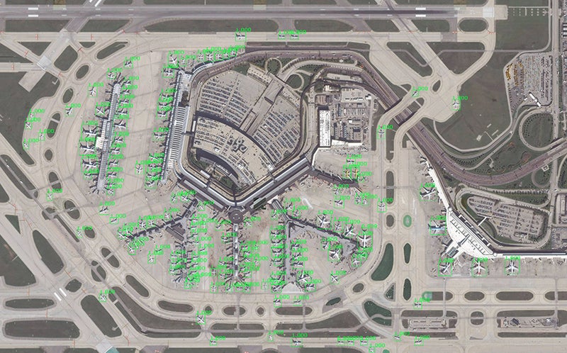
Lockheed Martin developed a satellite imagery recognition system using open-source deep learning libraries to quickly identify and classify objects or targets in large areas across the world. According to the release, this could save image analysts hours manually categorizing and labeling items within an image. Global Automated Target Recognition runs in the cloud, using Maxar’s Geospatial Big Data platform (GBDX) to access Maxar’s 100 petabyte satellite imagery library and millions of curated data labels across dozens of categories that expedite the training of deep learning algorithms. Fast GPU’s let GATR scan a large area very quickly, while deep learning methods automate object recognition and reduce the need for extensive algorithm training.
GATR teaches itself what the identifying characteristics of an object area or target, for example, learning how to distinguish between a cargo plane and a military transport jet. The system scales quickly to scan large areas, including entire countries. GATR uses deep learning techniques common in the commercial sector and can identify ships, airplanes, buildings, seaports, and many other categories.
“There’s more commercial satellite data than ever available today, and up until now, identifying objects has been a largely manual process,” said Maria Demaree, vice president and general manager of Lockheed Martin Space Mission Solutions. “Artificial Intelligence models like GATR keep analysts in control while letting them focus on higher-level tasks.”