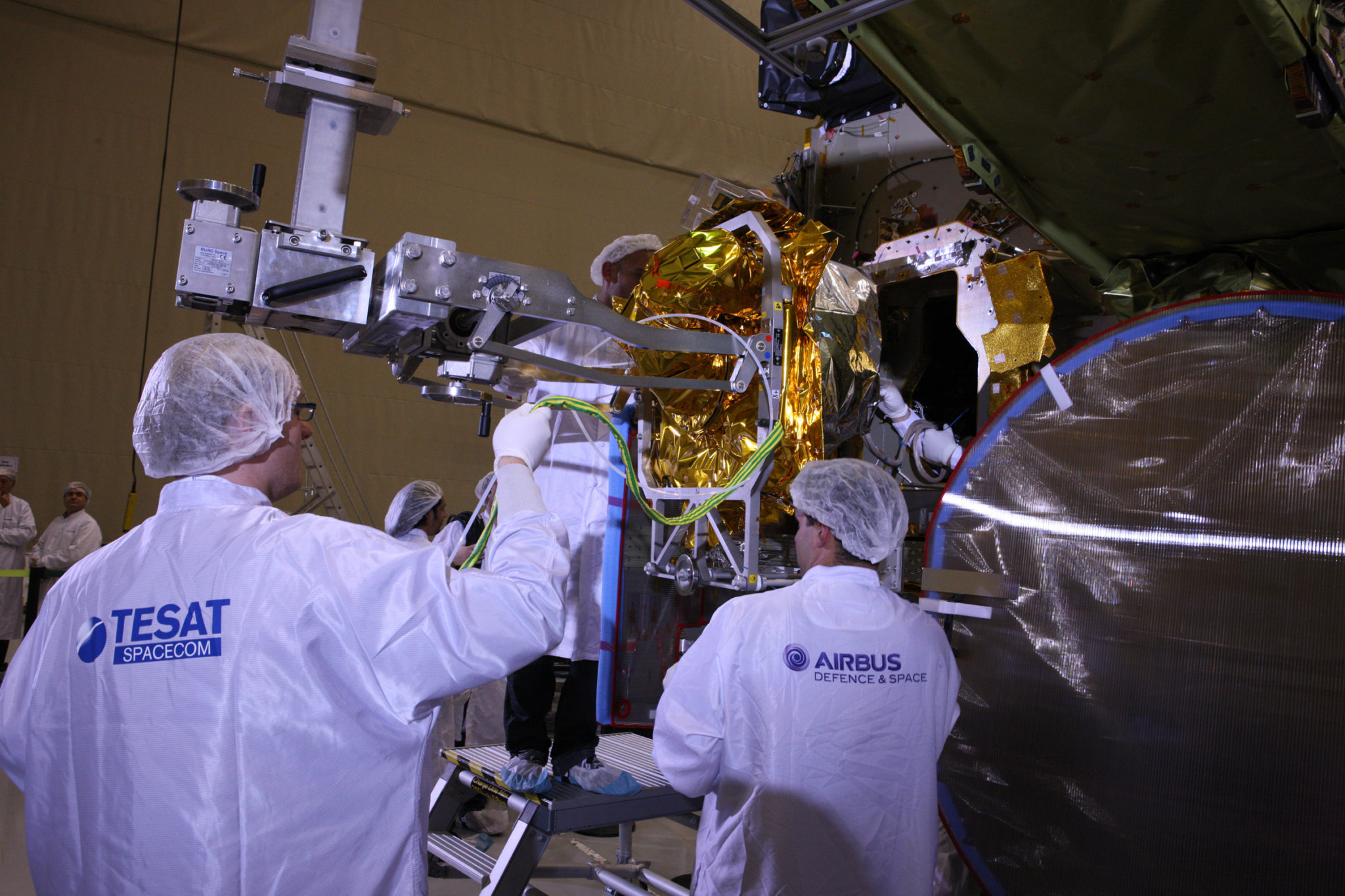
[Via Satellite 01-22-2016] With the launch of the first European Data Relay System (EDRS) payload only a week away, the European Space Agency (ESA), Airbus Defence and Space and other partners are preparing for the implementation of a first-regional, then global laser communications system. EDRS, also known as the SpaceDataHighway, is a Public-Private Partnership (PPP) between ESA and Airbus Defence and Space, with ESA and the European Commission as the system’s first customer and Airbus Defence and Space responsible for commercialization.
EDRS is capable of beaming 1.8 Gbps using Laser Communications Terminals (LCTs) developed largely by Tesat Spacecom in Germany under funding from DLR, the German aerospace center. The new telecommunications system is designed to speed up access to imagery collected by Earth Observation (EO) satellites that, situated in Low Earth Orbit (LEO), often have limited access to their associated ground stations.
At a Jan. 15 press conference, ESA EDRS Project Manager Michael Witting said that an EO satellite in a 90-minute orbit typically only has visibility with its own ground station for about 10 minutes, meaning it can only transmit data during that brief window, limiting the amount of data collected and introducing latency between the time of observation and when images are accessed on the ground. EDRS works by connecting with EO satellites from Geostationary Earth Orbit (GEO), where the telecom satellite can see the EO spacecraft. Data from the observing satellite is transferred to the EDRS payload using lasers, and an RF beam retransmits the information to the ground.
“The data relay satellite, depending on where it sits on the geostationary arc, has visibility of the imaging satellite for a very large part of the orbit — at least half of the time if you have one relay satellite,” said Witting. “If you have several of them, we can achieve situations or configurations where you have 100 percent of the time visibility, so you can have access to the data immediately, you can get it to the ground in what we call near-real time, and because of the high speed of the link, we can get much more data down than we can get down with the classical scenario.”
EDRS-A, the first node in the SpaceDataHighway, is scheduled to launch Jan. 29 (GMT) aboard an International Launch Services (ILS) Proton rocket as a hosted payload on the Eutelsat 9B satellite. The second node, EDRS-C, is planned for launch in 2017, with OHB of Germany integrating the payload into its satellite platform now. By slashing the time between observation and access, EDRS is expected to enhance services such as Information, Surveillance and Reconnaissance (ISR) disaster response and more. ESA Director of Telecommunications and Integrated Applications Magali Vaissiere, pointed to maritime as the market with potentially the greatest demand for SpaceDataHighway services.
“The maritime sector is the one currently crying out loudest for more real-time data. For example some important shipping routes go through the North Pole region where thick ices floes can cause damage to cargo and vessels, and even threaten human life. It is also an environment which is in constant motion, so that data that is two days old is not only unhelpful, it could even be unsafe,” she said. “EDRS is supposed to make this data accessible quickly.”
Vaissiere said a joint study conducted between ESA, the European Commission and Airbus found that of an estimated 400 LEO launches between now and 2030, 20 percent would include candidates for EDRS services. Based on this study, SpaceDataHighway partners estimate that the commercial value of quasi real time data — i.e. accessed within one hour — is two to three times higher than near real time, which is accessed in less than three hours.
Commissioning tests with EDRS are planned for May using the Sentinel 1A and 2A satellites and EDRS-A. Volker Liebig, director of EO programs at ESA, said Sentinel 3 will not use EDRS because it carries multiple payloads with an emphasis on radar, which creates much less data, compared to the other Sentinel imaging satellites. LCT payloads are on, or are planned for, Sentinel satellites 1A, 1B, 2A and 2B.
Evert Dudok, head of Communication, Intelligence and Security (CIS), at Airbus Defence and Space, said the ground segment and mission operation center underwent successful testing in December 2015. EDRS will use three ground stations: one in the United Kingdom, one in Germany, and one yet to be built in Italy. He also said Airbus Defence and Space is seeking out international partners to expand EDRS. The first two payloads provide coverage primarily over Europe and Africa. With partners, the aim is to expand the system globally to include the Americas and the Asia Pacific.
“We are looking for partners to deliver the system. It can be a dedicated payload, [or] it can also be a hosted payload as we have it on EDRS-A. We are very much open to that. We want to have that system operational by 2020,” said Dudok.