Satellogic is working with geospatial and AI analysis software company Astraea to distribute Earth observation data directly to the Ukrainian government, allied governments, and humanitarian organizations on the ground for the emergency response in Ukraine.
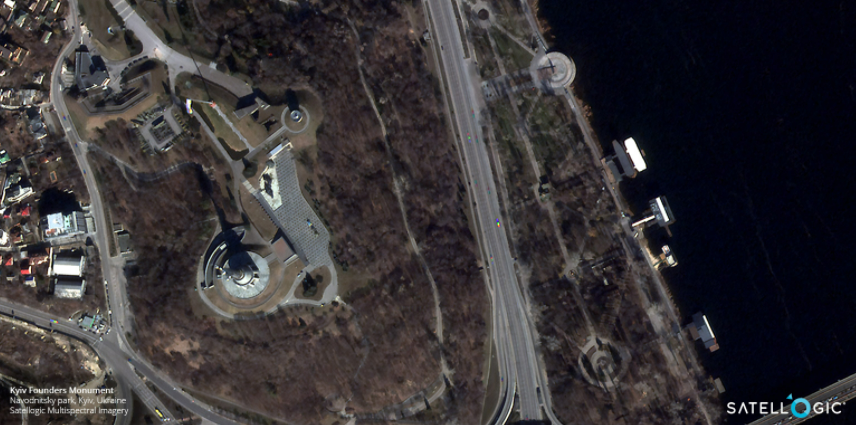
Satellogic is providing its Daily Collection Access service to the Ukrainian government and allied nations. This service delivers a direct stream of high-resolution satellite imagery collections over Ukraine’s sovereign territory as well as neighboring areas of interest. The company said its satellite imagery offers visibility to monitor military movement, assess post-event damage, and plan civilian evacuation routes.
Astrea is providing a secure interface to make the data available to approved humanitarian and non-governmental organizations. Satellogic said the service is intended for peaceful use only.
“A good portion of our engineering team is Ukrainian and is on the ground in Kyiv and other places in the country. Hence, this is deeply personal for us. We are focused day and night to help those we work with and care deeply about – and to leverage the power of EO data to save lives, protect innocent civilians and undo the damage caused by conflict,” said Brendan Richardson, co-founder and CEO of Astraea.