

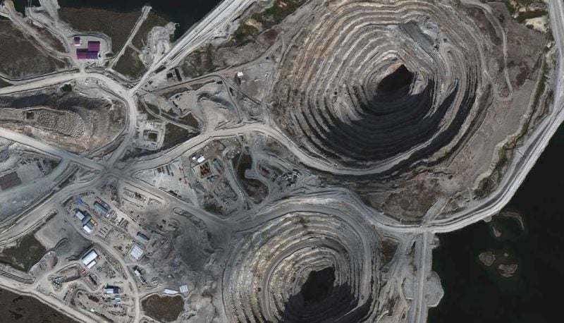
Zacatecas Silver Corp. is using high-resolution satellite imagery to conduct resource estimates at the Panuco Silver Deposit in Zacatecas State, Mexico. The company announced March 26 that it acquired its imagery from Maxar‘s Worldview-3 satellite and the German Aerospace Center‘s (DLR) TerraSAR-X satellite.
Satellite imagery and sensing companies have been trying to expand their operational footprint in several enterprise verticals — especially in the lucrative mining sector. Zacatecas contracted Maxar’s Worldview-3 and DLR’s TerraSAR-X to survey all areas where it holds licenses to mine for silver and included a 2 km-wide edge buffer between licensed areas.
Zacatecas said the Worldview-3 coverage ensured that geology, alteration, structure and mineralization could be placed in a wider context and mapped between licenses. “The [Worldview-3] imagery provides 34 cm visible (panchromatic) and 1.36 m 8-band multi-spectral VNIR resolution —it has provided a detailed base image allowing for rapid field verification and geological mapping at Panuco and other targets within the Zacatecas land-holding,” the company explained in the announcement.
DLR’s TerraSAR-X was tasked to provide 20 ground control points at less than 1-meter accuracy in 3D space covering the entire 315 square-kilometer area of the Worldview-3 image, and acquire data on six different silver deposits at Panuco and El Cristo, Mexico.
“The acquisition of such high resolution integrated satellite data has provided an exceptional GIS dataset that has allowed field geologists to rapidly re-map the Panuco and El Cristo projects. Interpretation of Worldview-3 data is providing excellent structural data for input into deposit models,” said Zacatecas COO Dr. Chris Wilson.


