
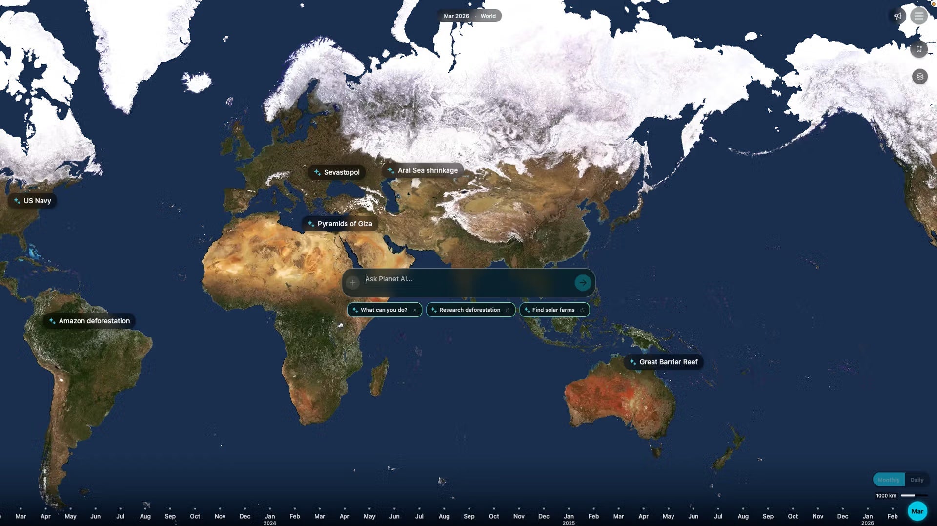
Planet is building an agentic AI geospatial query, where users could ask a question like “Where are new construction sites appearing in Florida?” and get an answer.
The agent is designed to search Planet’s imagery archive, identify matching locations, and highlight them on the map. It is also designed to analyze sites over time, interpret visual features, and create a shareable report with embedded satellite imagery. Planet detailed the agentic geospatial AI in a May 21 blog post.
The feature is currently in private beta mode.
One main benefit of this tool Planet highlighted is to make it easier for stakeholders who don’t have a geospatial background to use and draw insights from geospatial data — like insurance adjusters, infrastructure managers, or civil government officials.
“By automating complex geospatial processing that once took days or weeks, Agentic AI compresses decision loops into minutes. This capability allows organizations to understand and respond to our changing planet in near-real time, and transition from reactive monitoring to proactive management,” Mariah Hauck, Planet’s manager of growth marketing campaigns, wrote in the post.
Planet put this new tool in the context of “planetary intelligence,” the company’s broader goal to integrate AI across its value chain including edge computing onboard satellites, and training models on its archive of data.