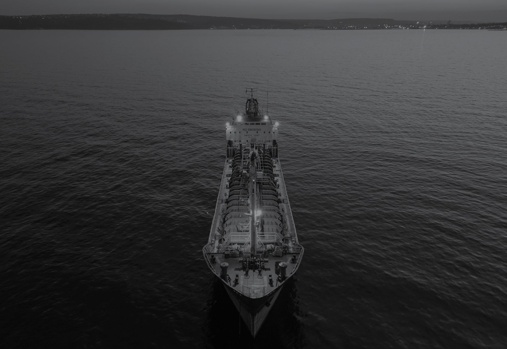

The date is April 10. Iran has closed the Strait of Hormuz in retaliation to strikes by the U.S. and Israel, triggering a regional war. An infamous very large crude carrier, VLCC ship, is spotted transiting the Strait, uniquely granted safe passage through the restricted waterway, having changed its flag to that of Russia earlier in January. Its cargo likely comprises a great deal of crude oil, the lifeblood of a global economy beginning to seize. Satellites watch on, as another of the world’s great dark ships flaunts international order.
As reported by Bloomberg, the VLCC Arhimeda, blacklisted by the U.S. Treasury Department in July last year under another name, Vizuri, was alleged to possess links to the Iranian oil trade, owned and managed by a shadowy company in the Seychelles, and technically managed by another uncontactable group in Azerbaijan.

Explore the June/July 2026 Issue
Check out more from this issue and find your next story to read.
The vessel’s patchwork of international allegiances, all largely unaccountable for the ship’s activities, may christen the ship a new name in mere months, with a new flag, crew, and clandestine mission. Under new colors, and telling a different story, how will ports guess its illicit past?
Today, the developers of hyperspectral satellite technology have begun discussing the capability to lend hyperspectral imaging to our existing geospatial toolkits to detect the ships in this new dark fleet, who not only evade sanctions on precious or illegal commodities and break embargoes, but deal in human trafficking, the dumping of toxic substances at sea, and more.
Hyperspectral sensors read continuous, narrow wavelengths across the electromagnetic spectrum of the sun, allowing spectral analysis of the invisible bands that comprise sunlight, beyond the visible bands that human eyes can capture and interpret. This capability captures a wealth of specific, unseen information. Experts say this data forms a “spectral fingerprint”, by which a vessel can be identified and reidentified from orbit, seeing beyond the story of flags and transponders.
The situation in the Strait of Hormuz “is a major global energy shock, arguably the biggest shock in modern energy history,” Antoine Halff, co-founder and chief analyst at Kayrros a Paris-based energy and environmental geoanalytics intelligence company, tells Via Satellite. “[Satellite] geospatial intelligence is radically changing how crises unfold. High-frequency imagery, vessel tracking, infrastructure monitoring and rapid data processing now allow markets and policymakers to observe physical reality with a speed and precision that would have been unimaginable even a decade ago.”
While procurers still possess a knowledge gap, and technologists admit hyperspectral imaging (HSI) is most powerful alongside other Earth sensing solutions, HSI offers governments, militaries, and public safety bodies a new stream of information, critical to cracking the rising epidemic of the ocean’s grey economy.
Sight Beyond Sight?
Making use of the data from the many bands of light beyond those that the human eye can see could one day represent a fundamental technology in imaging, a potential which can lead to some grandiose claims about what the technology can enable. This means it’s vital to recognize what executives are and are not claiming.
Tristan Laurent, co-founder and CEO of French hyperspectral startup Absolut Sensing, explains that hyperspectral optics capture hundreds of narrow spectral bands from visible to short-wave infrared, that reveal “unique chemical fingerprints” of materials on Earth’s surface or in the atmosphere. This can reveal “oil residues, specific minerals, vegetation stress, or greenhouse gases like methane that are invisible to standard cameras,” Laurent says.
He cites limits on the technology of coarser spatial resolution that is often 20 meters to 60 meters today, alongside large data volumes that require AI processing, along with challenges from clouds and sun glint.
AI pre-processing is often mentioned in conversations around hyperspectral. Earth sensing is thought to be one of the few in-space computing tasks of note, and so crucial to the wider industry trend of legitimizing orbital compute, though the technology is expensive, and may not suit new entrants to the market. Hyperspectral can serve many applications across disparate industries, from intelligence agencies to agriculture.
Limitations include difficulties with gas detection, especially in wind, chemical analysis beyond the spectral range in use, and the restrictions of a satellite’s specs, particularly in resolution rates. Something all technologists agree is that hyperspectral is not a complete answer, but a deeper layer, most effective when compiled into existing satellite intelligence kits.
“Hyperspectral sensors do detect surface chemical signatures like fuel residues, oil slicks, or exhaust plumes on dark vessels, enabling classification and anomaly flagging when fused with optical or synthetic aperture radar [SAR] data, as shown by certain operators in 2025 with campaigns in the Persian Gulf and East China Sea,” Laurent says.
Malathy Eskola, the commercial director of Kuva Space, a South Finland-based company specializing in spaceborne hyperspectral data, adds coatings, residues, plumes, biomass, and other anomalies to that list, so long as hyperspectral sensor’s sensitivity is adequate. Hyperspectral evidence makes denial less plausible – a pillar of any grey economy – enabling a verifiable data source to support legal and diplomatic counteractions.
Some companies claim this toolkit can even determine a dark vessel’s present and past cargo, based on unseen clues left behind on deck, though Absolut’s Laurent wasn’t convinced.
“Direct enclosed cargo identification is nonsense – surface residues and behavior patterns provide some clues, but this is far from an operational application today,” he says.
Key to this burgeoning market is re-identification, in order to establish patterns and precedents for the notorious flagships of the dark fleet.
“We are building a library of hyperspectral signatures of ships to identify dark vessels, and our imagery has been used to detect certain chemicals, like nitrogen,” Chris Robson, CEO and co-founder of Wyvern, an Alberta-based hyperspectral satellite operator says. “It’s much harder to hide from hyperspectral than it is from regular Earth observation (EO).”
The Geo-economic Conversation
One of the key questions for the industry is how does this information translate into actionable conclusions that assist governments, authorities, and legislators with taking a stand against international crime at sea?
Executives point to how their platforms can optimize intelligence advantages at key zones of interest like the Strait of Hormuz.
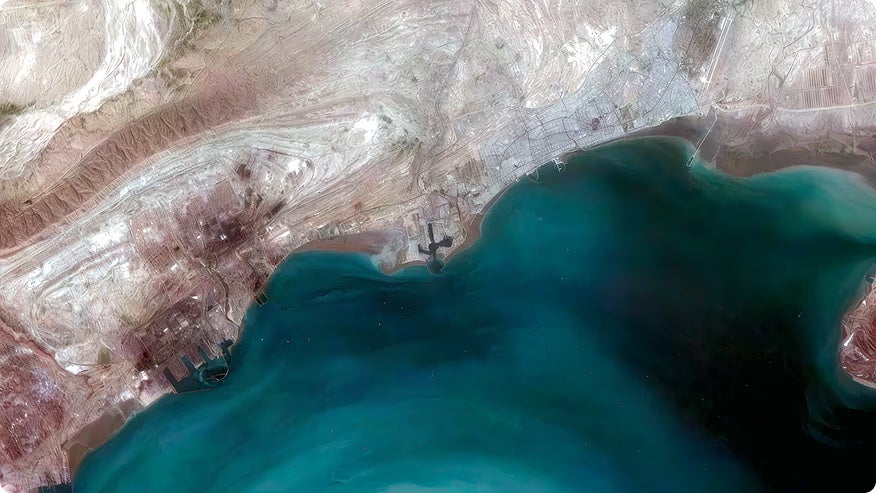
Kuva Space performed tracking at the Strait, preceding and following the February 28 commencement of the blockade, detailed in a media brief originally shared with journalists in connection with Washington Post reporting and made public on June 1. Its tracking illustrated, “multiple vessel detections without matching AIS signals before and after [the February 28 incident], and a marked shift toward non-AIS traffic in a strategically sensitive chokepoint,” Eskola says. “That is the real significance. Hyperspectral can help expose where the public or cooperative picture of maritime activity is incomplete.”
Change detection and anomaly identification are both cited as applications where hyperspectral from Low-Earth Orbit (LEO) excels, flagging peculiarities beyond sight, as and when they’re spotted. These data points call back to the fingerprint analogy.
“If you have a spectral fingerprint on file and you can see it in an image, it’s very tough to hide from,” Wyvern’s Robson says. “Countries are preparing for the advent of widespread access to hyperspectral imagery. That includes learning how to process and analyze it, onboarding new satellite providers, and starting to think about countermeasures. The broader shift is toward more robust attribution. Moving from visual interpretation to physics-based signals makes it easier to defend conclusions and harder to dispute them. That will have real implications for how evidence is used in international contexts.”
The normalization of hyperspectral evidence in real courts has a legal dimension beyond the expertise of the satellite market, but is sure to appeal to lawyers and courts alike.
“Formal use [of hyperspectral data] in court will depend on the auditability of the data pipeline, from sensor through AI processing to the courtroom,” says Andrew Cavalier, principal analyst at ABI Research’s Singapore office. “This forensic defensibility of that something that the market is actively working to standardize.”
Some argue there are more immediate advantages to full geospatial breakdowns of unfolding geopolitics, which grant assurances to volatile international markets.
“Transparency changes behavior,” Halff says. “Uncertainty tends to be a force multiplier. Thanks to geospatial information streams, there is less uncertainty, and that’s changing how the markets react.”
Safer Seas
Hyperspectral, by its nature, serves a span of industries beyond governments and militaries, a fact that, especially in Europe, has led some to insist the technology is as much a peacetime tool as one applicable to war.
“It is important not to frame [hyperspectral] too narrowly as a conflict-only tool,” Kuva Space’s Eskola says. “Illegal fishing, sanctions evasion, suspicious discharges, and dumping are all cases where the combination of vessel detection, material characterization, and anomaly detection can add real value.”
Cavalier cites that an estimated 14 percent to 26 percent of identified illegal fishing vessels are at high risk of forced labor. Illegal, unreported and unregulated fishing is cited to cost the global economy $10 billion to 25 billion a year, and has been cited for as high as a $50 billion impact.
A five-month operation by Interpol in 2021 called IKATERE that focused on investigating illegal fishing activities found that the vessels they were targeting routinely double as platforms for drug, weapon, animal, and even human trafficking.
Hyperspectral’s chemical analysis also makes it well-suited to determining the impacts of environmental damage, with effects such as phytoplankton blooms being one useful tell.
“Illegal fishing, dumping, oil discharge, and toxic release often alter the environment before they become visible through standard observation,” explains Awais Ahmed, founder and CEO of Pixxel. A US-Indian sun-synchronous hyperspectral satellite operator headquarted in El Segundo “Hyperspectral imaging can detect changes in water quality, surface films, algal stress, sediment plumes, and other indicators of ecological disturbance.”
While perhaps less serious, the rank-and-file dark fleet in the world of simple black-market fishing and toxic dumping forms an economic bedrock supporting higher profile crime. As this field of criminality has grown, government and inter-government groups have begun devoting more resources to doing something about it.
“The dark fleet has demonstrated they can now operate at industrial scale while still being hard to enumerate, insure, and interdict,” Cavalier says. “That has shifted recognition. The International Maritime Organization formalized a ‘dark fleet’ definition in late 2023, and the EU has sanctioned hundreds of vessels, with many now being physically detained – moves that would have been unthinkable five years ago.”
The argument hyperspectral providers face is not the seriousness of the issue, but the necessity of their technology forming a pillar of the full stack of satellite intelligence tools. The data can deliver both coverage and low latency by aiming to improve revisit rates down to sub-daily levels, allowing authorities to be alerted at the breakneck pace at which the world’s geopolitical and macro-economic fabric moves.
Where is the Demand?
Global tensions have given rise to a concerted interest in Earth sensing technologies via satellite to reinforce intelligence capability and modernize militaries for states facing belligerent neighbors.
Wyvern CEO Robson expects both small and great powers to use more intelligence products derived from commercial hyperspectral data over the next five years.
“The companies that succeed will be the ones that translate hyperspectral into actionable information that fits into decision-making workflows [of users] that yield a positive and material ROI and are ultimately profitable to the company,” he says.
Some suggest smaller powers will prioritize synthetic aperture radar (SAR) and very high resolution (VHR) Earth Observation, with hyperspectral being the preserve of the great powers. Others feel that increasing budgets and new geopolitical realities are changing that.
“Small and mid-sized states with contested exclusive economic zones (like in the Indo-Pacific) are now also plausible anchor customers – reshaping the typical buyer base for this technology,” Cavalier says.
“Defense and intelligence communities will remain an anchor client for these services, but pipeline integrity, precision agriculture, mining, and aquaculture are becoming credible commercial demand drivers,” he adds. “The technology is dual-use and the commercial revenue opportunity will rival defense spend by the end of the decade.”
With the news cycle as sensational as we’re seeing, it’s easy to predict hyperspectral seeing itself a crucial note in a terrifying piece of breaking global news. The hope is that both the technology – and its levels of accessibility – is ready to be thrust into the spotlight when and if that occurs.
“We are seeing constellation buildout ramp up with hundreds of satellites projected to be deployed by 2030,” Cavalier predicts. “With onboard AI/edge processing and even orbital compute gaining momentum, compression of data pipelines from detection to insight to remediation can be expected.” VS