On Sunday, a volcano erupted in Guatemala killing at least 25 people and injuring hundreds, according to Reuters. The eruption of Volcan de Fuego, which translates to Volcano of Fire, is the most violent in the country in decades, and its second eruption this year. The lava has reached a 5-mile radius and spewed black smoke and ash that has caused airports to be closed and some rescue efforts to be suspended. Volcan de Fuego is located about 25 miles from Guatemala’s capital, Guatemala City.
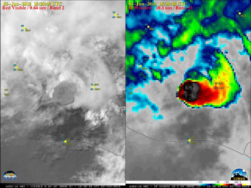
The eruption was so violent, NOAA’s GOES East satellite captured it from space. Here are some of the most striking images:
#GOESEast captured the #FuegoVolcano eruption exploding through the clouds over #Guatemala yesterday. #GOES16 #Fuego https://t.co/H8RKak4Jib pic.twitter.com/q8bfAcoj6U
— UW-Madison CIMSS (@UWCIMSS) June 4, 2018
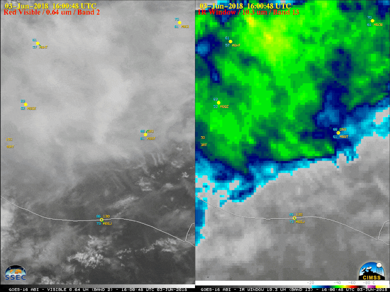
#volcandefuego eruption followed by orographic convection in Guatemala today #GOES16 #GOESEast pic.twitter.com/EsqjBJGhAq
— Brendon 🌪️🐻❄️ (@brendonme) June 4, 2018
Ash cloud from the eruption #FuegoVolcano in #Guatemala observed by #Goes16 – RGB Composite, on 3rd of June. #volcandefuego @NOAASatellites @NASA pic.twitter.com/1t26PgckhS
— Annamaria Luongo (@annamaria_84) June 4, 2018