Imagery and Sensing
July 22, 2024
Planet Labs signed a seven-figure contract expansion with a U.S.-allied international government agency for SkySat satellite data. Planet announced the SkySat expansion with the unnamed allied nation on Monday. Specific terms of the deal were not disclosed. The SkySat fleet provides satellite imagery up to 50 cm resolution with the ability to have multiple revisits…
July 19, 2024
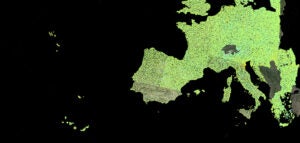
e-GEOS has won a new five-year contract from the European Environment Agency (EEA) which will enable better detection and measurement of ground movements from space. The contract is for the end-to-end implementation and operation of the European Ground Motion Service (EGMS). e-GEOS will lead an international consortium ‘ORIGINAL’ (OpeRatIonal Ground motion INsar Alliance) on the…
July 18, 2024
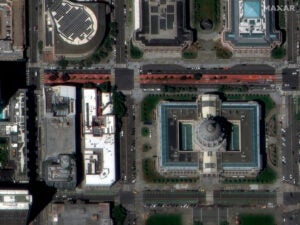
Maxar Intelligence released the first set of images from its new WorldView Legion satellites. The images released Thursday show the 30 cm-class imagery capabilities of the satellites, capturing views of San Francisco and Sacramento, California. This is a major milestone for Maxar’s next-generation imagery constellation. These first two satellites launched in May after years of…
July 15, 2024
Planet Labs has signed a new seven-figure pilot program with an international ministry of defense (MoD) customer for PlanetScope data enhanced with SynMax artificial intelligence. Planet announced the deal with the unnamed customer on July 15. Planet and SynMax are providing a maritime domain awareness solution for vessel detection and monitoring. The customer also expanded…


