
Imagery and Sensing
-
 Finance
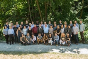
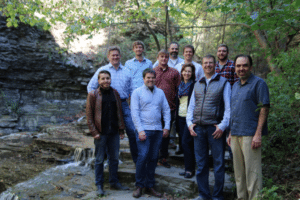
Ursa, RRE on New Funding and the Future of Geospatial Intelligence
“From an image to an answer,” Ursa Space Systems Chief Executive Officer (CEO) Adam Maher said as he proudly described how his geospatial analytics company conducts its business. He started […]
-
 Imagery and Sensing
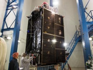
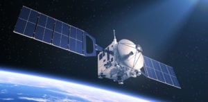
Lockheed Martin GPS III Satellite: “Available for Launch”
The U.S. Air Force declared that the second Lockheed Martin-built Global Positioning System GPS III satellite is complete, fully tested, and ready to launch. The Air Force’s Available for Launch declaration is the […]
-
 Government/Military
FAA Approves Installation of Aersale’s AerTrak on Boeing 757-200
The Federal Aviation Administration (FAA) issued a Supplemental Type Certificate (STC) for installation of AerSale’s AerTrak system on Boeing 757-200 series aircraft (ST04011NY), to comply with the Automatic Dependent Surveillance-Broadcast […]
-
 Finance
HawkEye360 Debuts Partner Program, Includes Eagle Technology
HawkEye 360 broadens access to its products with the introduction of a strategic partner program, including Eagle Technology as the strategic partner for New Zealand. HawkEye 360 is first commercial […]
-
 Finance
UrtheCast to Purchase Geosys from Land O’Lakes
UrtheCast and Land O’Lakes have entered a binding term sheet for the purchase of Geosys Technology Holding, a wholly owned subsidiary of Land O’Lakes, for a purchase price of $20 […]
-
 Finance
DigitalGlobe Appoints 2 Leaders to World Geospatial Industry Council
DigitalGlobe, a Maxar Technologies company, appointed two leaders to the World Geospatial Industry Council (WGIC), formed during the 8th session of the United Nations Global Geospatial Information Management (UN-GGIM) held […]
-
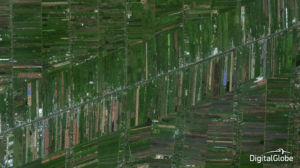
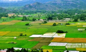 Connectivity
How India’s Farmers Grow Profits with Satellite ‘Big Data’
For India’s farmers, doubling their annual income over a five-year period translates into enabling them to grow at more than 1.5 times the rate of the nation’s entire Gross Domestic […]
-
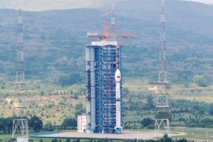 Imagery and Sensing
High-Resolution Earth Observation Satellite Launches from China
China launched Gaoefen-11, an optical remote sensing satellite, as part of its high-resolution Earth observation project. The Gaofen-11 satellite was launched yesterday on a Long March 4B rocket at 11 […]
-
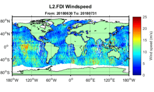 Finance
SSTL to Launch GNSS-Reflectometry Ocean Wind Data Service
Surrey Satellite Technology (SSTL) and the National Oceanography Center (NOC) launched the first Global Navigation Satellite Systems (GNSS)- Reflectometry ocean wind data service that is global, with support from the […]
-
 Finance
Planet Hires Nathan Dickerman as Chief Commercial Officer
Planet has made a key new executive hire as it looks to build its business. It has appointed Nathan Dickerman today as Chief Commercial Officer (CCO). Dickerman will be responsible […]
-
 Imagery and Sensing
Phillips Seed Gains Access to Farmers Edge’s Satellite Imagery
Data-driven agricultural solution provider Farmers Edge and Phillips Seed Farms will collaborate to accelerate genetic development with digital agronomic tools, including daily satellite imagery. Phillips Seed will increase digital connectivity […]
-
 Finance
New Funding to Accelerate LeoLabs LEO Mapping
LeoLabs, a commercial provider of Low Earth Orbit (LEO) mapping and Space Situational Awareness (SSA) services, closed a $13 million Series A financing round led by global investors WERU Investment […]
-
 Finance
Ursa Space Systems Receives $5.7 Million in Venture Funding
Geospatial intelligence solutions startup Ursa Space Systems received $5.7 million in new venture funding, led by RRE Ventures, with participation from S&P Global and Paladin Capital Group. The funding follows […]
-
 Government/Military
NASA Online Toolkit Promotes Commercial Use of Satellite Data
NASA is promoting a new toolkit that will make it easier for commercial companies than ever to search, utilize and analyze data that NASA produces. Previously, free and open remote-sensing […]
-
 Imagery and Sensing
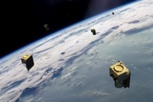
Mu Space To Launch New LEO Satellite
Mu Space plans to launch a new satellite into Low Earth Orbit (LEO) in a significant strategic move. The company will collaborate with SSL, a Maxar Technologies company and provider […]
-
 Finance
BlackSky selects Atlas for Earth Imaging Satellite Data Support
BlackSky, a division of Spaceflight Industries, selected satellite communications provider Atlas Space Operations to provide telemetry, commanding, and data support for its high-revisit, Earth imaging satellite constellation. Atlas will be […]
-
 Government/Military
ESA Imagery Contract Given to Deimos Imaging
A consortium led by Airbus Defense and Space, and involving Planet, IGN-France and Space4environment, awarded a multi-million Euro contract to UrtheCast and its subsidiary Deimos Imaging, to provide a large […]
-
 Finance
DigitalGlobe Taps Retired Air Force Colonel to Lead Defense Programs
DigitalGlobe has appointed U.S. Air Force Col. (Ret.) Mike Edwards vice president and senior advisor for defense programs, the Maxar Technologies-owned imagery satellite operator announced July 5. Edwards will report […]
-
 Government/Military
Radiant Solutions Now Prime Geospatial Data Contractor for NGA
The National Geospatial-Intelligence Agency (NGA) selected Radiant Solutions, a Maxar Technologies company, for its Janus Geography Program. The contract is worth $920 million and may last up to 10 years. […]
-
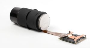 Imagery and Sensing
SAC to Develop Hyperspectral Camera for Cubesat Mission
Space Advisory Company (SAC) is to develop the highest resolution hyperspectral camera yet to fit into a Cubesat. The company will produce the Chameleon Imager for the standard CubeSat 2U […]
-
 Imagery and Sensing
CGIAR to Use DigitalGlobe’s Big Data Platform for Agriculture
CGIAR (formerly the Consultative Group for International Agricultural Research) will leverage DigitalGlobe’s Geospatial Big Data platform (GBDX) to answer agricultural questions across the globe by using machine learning at scale. […]
-
 Imagery and Sensing
Planet, Airbus Join to Develop Imagery and Sensing Solutions
Planet and Airbus have signed an agreement that will see the two companies developing a suite of new geospatial solutions. The two companies will provide customers with a comprehensive range […]
-
 Government/Military
Northrop Grumman’s SIRU Features on Advanced Weather Satellite
Northrop Grumman has contributed to an advanced weather satellite that enables improved weather prediction capabilities, leading to more accurate and timely forecasts, watches and warnings. The Geostationary Operational Environmental Satellite […]
-
 Government/Military
Harris Delivers Advanced Sensor to Boost Japan’s Greenhouse Gas Monitoring
Harris Corporation has delivered an environmental monitoring sensor for the Greenhouse Gases Observing Satellite-2 (GOSAT-2), which will significantly enhance Japan’s ability to monitor greenhouse gases from space. The Harris-built Thermal […]
-
 Government/Military
Orbital Insight, e-GEOS Offer Flood Relief Services to US Gov
Geospatial analytics provider Orbital Insight has signed an exclusive agreement to bundle its products with the Emergency Flood Mapping Services of e-Geos for the U.S. government. This partnership provides government […]
-
 Finance
Esri, DigitalGlobe Create Exclusive Story Map for FIFA World Cup
Spatial analytics provider Esri and DigitalGlobe have created a story map of high-resolution imagery that visualizes the 12 venues being used for the 2018 FIFA World Cup in Russia, exclusive to The […]
-
 Imagery and Sensing
SolAero to Manufacture Solar Panels For SSL
SSL has selected SolAero Technologies, a provider of high efficiency solar cells, solar panels, and composite structural products for satellite and aerospace applications, for the design, manufacture and testing of […]
-
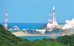 Government/Military
Japan Places Eighth Reconnaissance Satellite in Orbit
Japan has put another satellite into orbit to gather intelligence for national security purposes, as reported by NHK. An H2A rocket carrying the intelligence-gathering satellite lifted off from Tanegashima Space […]
-
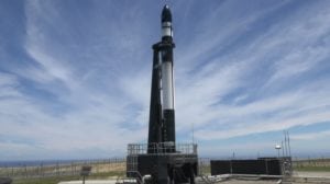 Imagery and Sensing
Black Sky, Canon Electronics Sign on for Spaceflight’s Upcoming Rocket Lab Launches
Spaceflight, a satellite rideshare and mission management provider, has partnered with Rocket Lab for three upcoming launches. The first Electron mission, scheduled for the end of 2018, will launch a […]
-
 Imagery and Sensing
ImageSat International, Magnus Launch Disaster Management Service
ImageSat International, an end-to-end geospatial solutions provider, and Magnus International Search and Rescue have launched an Emergency and Disaster Management service that enables countries, cities and remote government areas to […]