
Imagery and Sensing
-
 Imagery and Sensing
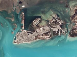
RemoveDebris Satellite Sees Success in New Test
Space engineers have teased images taken in-orbit by the RemoveDebris satellite, marking another successful Active Debris Removal test by the international project. RemoveDebris carried out a test of its […]
-
 Imagery and Sensing
Vietnam to Launch MicroDragon Earth Observation Satellite in December
MicroDragon, a miniaturized satellite developed by Vietnamese engineers, is scheduled to be launched in December with the assistance of Japan. The launch was announced on October 18 by the Vietnam […]
-
 Government/Military
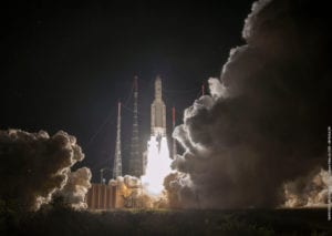
Arianespace Successfully Launches Mercury-bound BepiColombo Spacecraft
Arianespace launched a heavy-lift Ariane 5 rocket carrying BepiColombo – Europe’s first mission to Mercury, organized in cooperation with Japan – on its way toward the solar system’s smallest and […]
-
 Government/Military
Radiant Solutions Awarded $92 Million NGA Contract
Radiant Solutions was awarded a contract worth $92 million on a Small Business Innovation Research (SBIR) Phase III contract with the National Geospatial-Intelligence Agency (NGA). Radiant Solutions is tasked to rapidly develop, […]
-
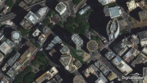
 Connectivity
DigitalGlobe Reveals New IOT Agriculture Product
Maxar Technologies company DigitalGlobe released Sensing4Farming, an Internet of Things (IOT) product for smart, digital, and precision agriculture created in partnership with Vodafone Spain. Sensing4Farming aims to provide crucial insights about […]
-
 Imagery and Sensing
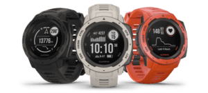
Garmin Reveals New GPS Watch with GLONASS, Galileo Support
Garmin announced Instinct, a watch with Global Positioning System (GPS), Russia’s Global Navigation Satellite System (GLONASS), and Europe’s Galileo satellite support, built-in 3-axis compass, and a barometric altimeter. In addition […]
-
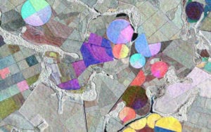
 Imagery and Sensing
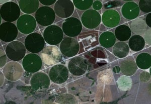
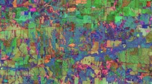
How Will Precision Agriculture Feed the World?
By the year 2050, the world’s population is expected to hit 10 billion. Feeding that population will mean increasing global food production by 70 percent — without poisoning the world’s […]
-
 Government/Military
NASA Contracts With DigitalGlobe, Planet, Spire for Earth Science Data
NASA is evaluating how data from the commercial small satellite industry could supplement its own Earth science data. The agency launched a pilot program to evaluate the data, and on […]
-
 Mobility
Spire Global, Indmex Aviation Partner to Develop Aviation Surveillance Solutions
Spire Global, a space to cloud analytics company, and Indmex Aviation, a provider of surveillance solutions, will cooperate in the development of space-based Automatic Dependent Surveillance-Broadcast (ADS-B) for the development […]
-
 Imagery and Sensing
Carr Astronautics to use Solace Platform for GOES-16 Stream
Carr Astronautics selected Solace‘s PubSub+ Cloud platform to power its delivery of real-time weather satellite data for their WxLiveStream product. Chosen for its reliability, scalability and efficiency, the platform will […]
-
 Imagery and Sensing
LeoLabs to Build Space Radar in New Zealand
LeoLabs, a commercial provider of Low Earth Orbit (LEO) mapping and Space Situational Awareness (SSA) services, has agreed to build its next space radar in New Zealand. This establishes New […]
-
 Finance
Orbital Insights to Provide Geospatial Analytics to RBC Capital Markets
Orbital Insight, a provider of geospatial analytics, and RBC Capital Markets, the corporate and investment banking arm of Royal Bank of Canada (RBC), formed a global partnership giving RBC Capital […]
-
 Imagery and Sensing
Capella Space Closes $19M of Funding, Prepares for Launch
Capella Space, an aerospace and information services company providing on-demand Earth observation data, closed $19 million Series B funding led by Spark Capital and DCVC (Data Collective) and joined by […]
-
 Government/Military
DigitalGlobe Receives DARPA Contract for Geospatial Cloud Analytics
DigitalGlobe has been awarded a contract valued at $3.2 million by the U.S. Defense Advanced Research Projects Agency (DARPA) to provide an unclassified environment with multi-source content for geospatial cloud analytics. […]
-
 Finance
GHGSat Raises $10M in Financing led by OGCI Climate Investments
GHGSat, a company providing global emissions monitoring services, raised $10 million in Series A2 financing led by OGCI Climate Investments. Building on GHGSat’s work in detecting and quantifying greenhouse gas emissions from […]
-
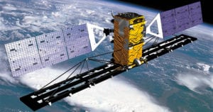
 Imagery and Sensing
Arianespace to Launch Kompsat-7 for Korea
Arianespace has been selected by the Korea Aerospace Research Institute (KARI) to launch Kompsat-7. Arianespace Chief Executive Officer (CEO) Stephane Israël and KARI President Lim Cheol-Ho signed the Kompsat-7 launch […]
-
 Government/Military
E-Geos Wins Contracts in Indonesia, Japan
E-Geos won an international contract announced by the Ministry of Marine Affairs and Fisheries (KKP) in Indonesia, in support of operations at the SAR (Synthetic Radar Aperture) ground station located […]
-
 Imagery and Sensing
Orbital Insight Extends Imagery Sourcing Contract with Planet
Planet and Orbital Insight, a geospatial analytics provider, entered a multi-year contract for Orbital Insight to source daily, global satellite imagery from Planet. The contract is an expansion of their previous […]
-
 Imagery and Sensing
Orbital Insight Acquires Gil Syswerda’s Boston-Based AI Firm
Geospatial analytics provider Orbital Insight has made its first acquisition – a privately-held, Boston-based artificial intelligence company, FeatureX. Founded by serial entrepreneur and machine-learning expert Gil Syswerda, FeatureX specializes in […]
-
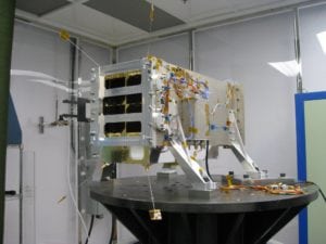
 Imagery and Sensing
ISRO Sends UK-Built SAR Imaging Satellite to Orbit
The Indian Space Research Organization’s (ISRO) PSLV launcher has successfully placed the Surrey Satellite Technology Limited (SSTL)-built NovaSAR-1 radar imaging satellite into orbit. NovaSAR-1, which carries an S-band synthetic aperture […]
-
 Imagery and Sensing
World’s Largest Food Company Taps Airbus for Deforestation Satellite Monitoring
Nestlé, the world’s largest food and beverage company, has contracted the Airbus-developed Starling satellite monitoring service to prevent losses in its palm oil supply chain due to deforestation. Airbus will […]
-
Finance
MDA to Deliver SAR Information for Maritime Surveillance
MDA, a Maxar Technologies company, signed a multi-million dollar contract with the South African National Space Agency (SANSA) for a one-year maritime surveillance program that includes the delivery of synthetic […]
-
 Finance
Radiant Solutions, TellusLabs to Offer Joint Agricultural Intelligence Products
Radiant Solutions, a Maxar Technologies company, and TellusLabs, a satellite imagery and machine learning company, are partnering to jointly offer agricultural intelligence products revealing insight on the world’s food supply, […]
-
 Government/Military
DigitalGlobe Receives Contract Renewal from NGA
DigitalGlobe, a Maxar Technologies company, received a renewal award for the Global Enhanced GEOINT Delivery (Global EGD) contract from the U.S. National Geospatial-Intelligence Agency (NGA). Global EGD provides U.S. government […]
-
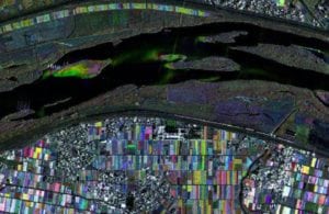
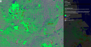
 Imagery and Sensing
PlanetWatchers Unveils Multi-Source SAR Analytics Platform
PlanetWatchers developed a new multi-source Synthetic Aperture Radar (SAR) platform that utilizes multiple SAR sources to deliver actionable insights without the usual delays due to weather, time of day, and […]
-
 Imagery and Sensing
Radiant Earth Foundation to Release Earth Imagery Platform
Radiant Earth Foundation (formerly known as Radiant.Earth) will release a new, open Earth imagery platform, to change the way humanitarian aid workers, policymakers, researchers, journalists, and others use satellite images […]
-
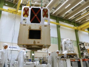 Imagery and Sensing
Sentinel-6A Reaches New Milestone, Prepares for 2020 Launch
The integration of Sentinel-6A, the first of two satellites to continue measuring sea levels from 2020, has reached a new milestone and its critical phase: the propulsion module has been […]
-
 Imagery and Sensing
Lockheed Martin’s GPS III Makes its Way to Cape Canaveral
The first of the U.S. Air Force‘s GPS III satellites is making its way to the launch pad. On Aug. 20, Lockheed Martin shipped the U.S. Air Force’s first GPS III […]
-
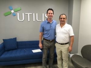 Finance
Satellite-based Leak Detection Provider Opens Location in U.S.
Utilis officially opened its new U.S.-based subsidiary in San Diego. Elected officials and representatives from local utilities attended the opening event to learn about new innovation in the leak detection […]
-
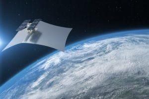
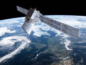 Imagery and Sensing
ESA’s Aeolus Satellite to Measure Wind Speed From Space
Aeolus, a European Space Agency (ESA) satellite, successfully launched from French Guiana on Aug. 22 after close to two decades of weather and engineering delays. The satellite will be the […]