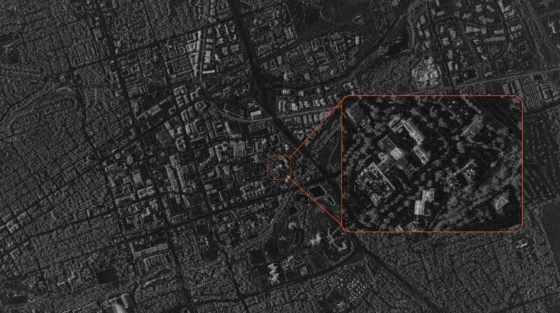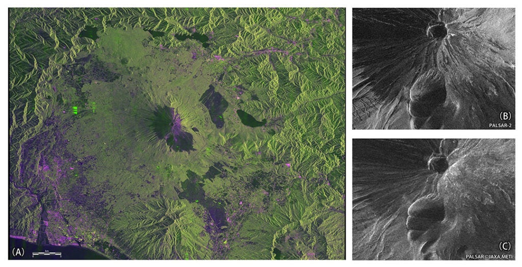
[Via Satellite 07-01-2014] The Japan Aerospace Exploration Agency (JAXA) obtained images from the second Phased Array Type L-band Aperture Radar (PALSAR 2) instrument, aboard the second Advanced Land Observing Satellite (ALOS 2), also called DAICHI 2. The satellite was launched on May 24, 2014 and is currently undergoing initial functional verification. These first images were captured during the verification stage.
JAXA will use the DAICHI 2 to contribute to information on disaster damage, monitoring deforestation and sea ice observation in the Sea of Okhotsk and Arctic region. After confirmation of DAICHI 2, observation data will be calibrated from mid-August. Images will be offered to the general public starting in late November.