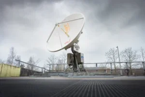
40 Years of Transforming Satellite Ordering and Tasking
From the start of commercial operations in 1986, it became clear to Spot Image that speed was a priority in the delivery of satellite image products for many end-user applications. Customers wanted the ordering process of new and archived images to be simple and quick. This led Spot Image and its successor companies, Astrium and Airbus, to continually refine ordering procedures, upgrading them over time from entirely manual to increasingly digital and automated processes.
For users of Airbus imagery, this autonomy meant performing their own searches of the vast archives, selecting their preferred image product, and downloading it directly to their GIS. These were significant advancements in commercial remote sensing, but the giant leap forward came in the 2010s when Airbus handed the satellite control “joystick” over to the customers and let them task their own new image acquisition.
Commercial remote sensing had entered a new era in which customers had far greater direct access to satellite imagery.
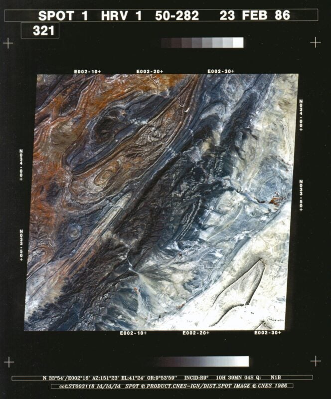
SPOT 1 and the Analog Era — 1980s
SPOT 1 launched in 1986, before digital ordering and online image searches became possible. Early on, Spot Image established two groups – Customer Care and Tasking – to work as a team ensuring the ordering of archived and new satellite imagery was as easy and as quick as possible. Email ordering and online image searches were still several years away, which meant most orders were placed via phone or fax.
Spot Image was a startup company in a startup industry. There were no templates or standards to guide how orders were taken and filled. The early Spot Image Customer Care team had to create their own procedures for determining what the customer needed, tasking the satellite to acquire the right image, and delivering products to end users.
For most of the SPOT 1 and 2 period, this entire process was manual, yet surprisingly simple. The early customers of SPOT data were mostly space agencies, mapping organisations, and governmental institutions with some experience using digital image data. Many had the computing power and specialised software needed to process the large files on magnetic tapes at their own facilities.
In thos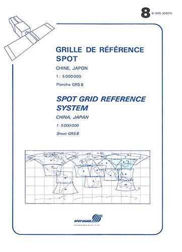 e early days, Stéphanie Le Grand, Project Manager for Earth Observation Global Customer Service, remembers there weren’t that many customers, and she and her colleagues got to know them all by name. Orders began with a phone call or fax from the client who usually identified their desired Area of Interest (AOI) by latitude/longitude coordinates.
Using paper KJ grid maps, Customer Care representatives converted these to a path/row number that identified the image scene covering the area.
“Customers were highly understanding of technological limitations. Filling orders often took weeks.”
Stéphanie Le Grand, Project Manager, EO Global Customer Service
Battleships in Orbit: The SPOT Grid Reference System
Long before modern agile satellites could acquire custom-shaped polygons on demand, the SPOT 1–5 era relied on a rigid yet remarkably effective global indexing framework: the Grid Reference System (GRS).
Similar to a global game of Battleships, the GRS structured the entire planet into a predictable grid based on satellite orbital paths. Columns (K, numbered 1 to 869 from west to east) defined orbital tracks, while rows (J, numbered 1 to 750 from north to south) indicated latitude. Each (K, J) intersection marked the precise centre of a standard 60×60 km scene. For early cartographers and commercial clients, this straightforward two-parameter coordinate replaced complex geographic calculations, establishing a universal cataloguing standard that governed satellite tasking and archive management for over twenty years.
Very early on, part of the new acquisition tasking process was given to a group called the Tasking Department. The job of tasking specialists was, and still is, to review the order for feasibility, suggest options to the customer, and even notify a customer of a request that is impossible to fulfill, such as acquisitions of imagery over too large a geographic area in too short a period of time.
“Our goal is to propose the best option according to the final use of the image. The objective is to save the satellite resource – to use it most effectively – while getting the image as soon as possible for the customer.”
Lionel Raspeau, Tasking Specialist
 Archive ordering was still manual. SPOT 1 and 2 initially captured imagery over land areas to fulfill orders and to expand the archive. These raw images underwent a first-level of processing, which among other things, evaluated their cloud cover. A small photographic “quick-look” print was also generated and kept in a file. The digital data was stored on a magnetic tape and archived in a physical location.
When an order came in for an archived image, the customer rep would check its availability and then find the quick-look print in a downstairs storage room to determine if the customer’s precise AOI was visible and whether it was cloud covered or hazy. In some cases, the quick-look print was faxed to the client for review.
If approved by the customer, the magnetic tape was copied and shipped to the user. The tapes, also known as 9-track Computer Compatible Tapes (CCTs), were industry standard and usually accommodated one SPOT 1 image each. At 267 mm in diameter, the CCTs were cumbersome to handle and expensive to ship. Only a handful of organisations worldwide had the tape drives needed to read them in the 1980s.
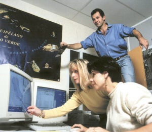 As the 1980s gave way to the 1990s, Spot Image, with assistance from CNES, was successfully expanding the Earth observation market beyond government institutions to private-sector commercial companies. The challenge, however, was that these organisations didn’t possess the data handling and image processing capabilities of traditional users.
For these non-expert customers, Spot Image developed a different, yet still highly manual, set of procedures for hardcopy production. Whether archived or new collect, the digital image file was then processed by Spot Image in Toulouse and a photographic print was generated for shipping to the customer.
The Digital Era Transforms Ordering – 1990s-2000s
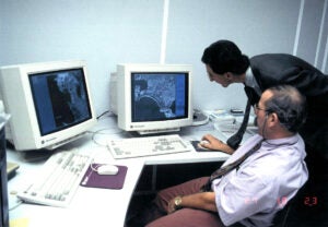
During the 1990s, as SPOT 3 and 4 were launched, the digital era began transforming the satellite imagery ordering experience as internal procedures evolved from strictly manual to partially automated. Spot Image Customer Care agents were equipped with a computerised tool to convert latitude/longitude coordinates into path/row numbers of the scenes containing the desired AOI.
By the mid-90s a computerised archive search tool called DALI was available to the customer service personnel. They could use their desktop computers to determine if an AOI scene already existed in the image archive.
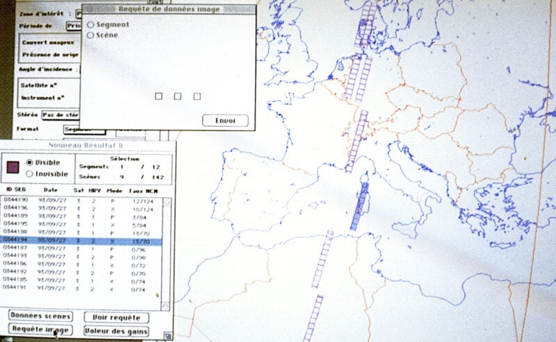
“By 1996 or 1997, we didn’t have to go down to the storage room. We could print the quick-look directly in our office and send it by fax to the customer.”
Stéphanie Le Grand
Requests for tasking of new acquisitions, however, still began with a paper order form filled out and sent to the Tasking Department to perform a feasibility study. By the late 1990s, Spot Image implemented an internal computerised ordering system called GESCOM. Customer reps could search the catalogue as before, but they could also use the new system to place orders for acquisition tasking as well as production of digital or photographic image products.
These changes enabled Spot Image to respond to image availability queries within minutes, dramatically enhancing the overall ordering experience of the customer.
By the launch of SPOT 5 in 2002, the digital era and improved onboard sensing capabilities had transformed the Earth observation market to include many smaller civilian companies in forestry, agriculture, and environmental monitoring. SPOT 5 further accelerated this evolution favouring smaller customers by introducing 2.5-metre spatial resolution and high-quality stereo imaging.
These capabilities opened the market to precision farming, telecommunications network planning, and 3D terrain simulations.
These commercial end users had different product requirements typically needing imagery for projects of smaller geographic areas. Spot Image was compelled to make a significant change to the structure of its ordering and production model.
“We decided to sell images by the square kilometer. Before that, we were just selling individual, huge image scenes. Customers had no choice. Even if they had a small project area, they had to order the whole scene.”
Stéphanie Le Grand
GeoStore Paves the Way for Direct Tasking — 2010s
In 2008, Spot Image empowered customers to perform their own search of the SPOT imagery archive with the introduction of the online GeoStore. For the first time, customers were no longer dependent on reaching a Customer Care Representative in Toulouse or a regional office to search for image availability, visually check scene quality, and place a product order – although Customer Care reps were still available to assist when needed, which was often.
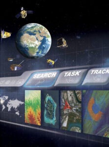 Customers could now do this themselves entirely online for all five SPOT satellites and eventually Pléiades 1A/1B. Payment accounts could be set up in advance allowing approved individuals within an organisation to pay when the order was placed.
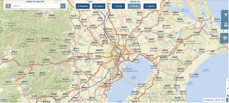
The most revolutionary feature of the GeoStore, however, was the Direct Tasking option, introduced in the early 2010s. This enabled customers to request new acquisitions by Pléiades and SPOT satellites as little as a few hours before the spacecraft passed over their AOI. This meant the end user could exploit an opening in weather conditions or catch an unexpected event on short notice. Tasking orders could be placed 24/7 by the user up to seven days in advance of the overpass.
Even with Direct Tasking, every order was reviewed for feasibility by a tasking specialist before being approved for acquisition by the satellite. This same overall process for evaluating Direct Tasking orders occurs today.
“We take into account all the parameters required by the customer and their specific application, and we conduct a feasibility study to determine whether the request is possible. If we are confident in acquiring the image, or believe some parameters need to be adjusted, we provide the best advice.”
Lionel Raspeau
As is still true today, a select group of customers were authorised for Emergency Tasking, which allowed their request to bypass the Tasking Department and programme the satellite for the acquisition. A steering committee was formed to evaluate potential conflicting orders between key customers.
GeoStore also introduced algorithmic support for feasibility assessments, giving the Tasking Department a more structured digital basis for reviewing customer requests. Otherwise, GeoStore eliminated the back-and-forth by phone, fax, and email with Customer Care although representatives were still there to assist with very large or complex orders. Overall, this online system greatly reduced ordering time.
One Tasking Changed the Promise
By July 2016, Airbus had taken the next step with the introduction of One Tasking, a new offer initially made available through GeoStore. Rather than adding another layer of technical options, One Tasking began reorganising satellite tasking around a smaller number of clearly identified customer needs.
But the introduction of One Tasking represented more than a simplification of the offer. Airbus was also reconsidering what customers were actually purchasing when they submitted a tasking request. Over the years, the tasking offer had expanded to include numerous acquisition options, technical parameters, and levels of priority. This provided flexibility, but it could also make the service difficult to navigate. More importantly, the customer was still primarily purchasing an acquisition attempt. Airbus would use its satellite resources and tasking expertise to obtain the requested image, but the final result could remain dependent on weather, satellite availability, and competing acquisition priorities.

The resulting offer was structured around a smaller number of clearly identified options based on customer needs:
ONE DAY supports customers that need an image on a specific day. A weather forecast provided in advance allows them to confirm, postpone, or cancel the request without unnecessary risk.
ONE NOW addresses situations in which an image is needed as quickly as possible, such as an emergency, a rapidly developing event, or another urgent operational requirement, while providing greater flexibility to account for suitable weather conditions.
ONE PLAN is intended for planned acquisitions and larger coverage projects that must be completed within a customer-defined period, with suitable acquisition dates and sensors selected according to project requirements.
MULTI-ACQUISITIONS supports regular or repeated monitoring of the same area at a chosen frequency.
The most significant change, however, was not the number or the names of the services. It was the commitment behind them.
“The real change was moving from making every possible effort to acquire an image to committing to deliver one. When customers submit a request under a committed One Tasking option, they know they will receive an image that meets the agreed requirements.”
Victor Baudin, Product Marketing Manager, Optical Constellation and Tasking
In the earlier model, the service was largely based on a best-effort approach. The satellite was programmed and Airbus used its available resources to maximise the probability of acquisition, but the customer ultimately retained part of the acquisition risk.
With One Tasking, selected services moved toward a result-based model. Once a request is accepted under the agreed service conditions, Airbus is not simply committing satellite capacity to make an acquisition attempt. It is committing to deliver an image that meets the defined requirements.
OneAtlas Took One Tasking to Scale – 2016 Onwards
As cloud technology began reshaping the Earth observation industry, the ordering and tasking process changed once again. GeoStore could not be upgraded because its architecture was not based on cloud technology, and the Pléiades Neo constellation backend was being designed entirely around cloud infrastructure. A new portal, OneAtlas, had to be built instead to fully exploit cloud technology.
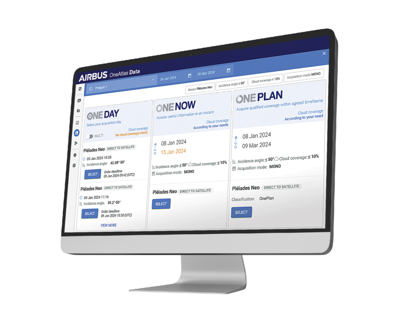 Upon its introduction in 2016, OneAtlas was initially designed primarily as a platform for archive access. Customers could search, purchase, and download archived imagery from SPOT 1-4, SPOT 6/7, and Pléiades, with Pléiades Neo 3 and 4 added following their launch in 2021. A separate area provided access to TerraSAR-X and TanDEM-X radar archive data. OneAtlas also gave customers direct access to the Living Library, a curated collection of high-quality imagery no older than 24 months.
For customers, this represented an important change in itself. Archive search, ordering, processing, streaming, and delivery could increasingly be handled within the same cloud-based environment, allowing users to access and manage much larger volumes of imagery.
Tasking Comes to OneAtlas
OneAtlas later evolved beyond archive access with the addition of tasking functionality. One Tasking, which had first been made available through GeoStore, could now be accessed through a cloud-based platform designed to support broader access, larger data volumes, and a growing satellite constellation.
This marked the next major step in the development of One Tasking. OneAtlas did not change its fundamental promise – the commitment to deliver an image that met the agreed requirements – but it significantly expanded the scale on which the service could be offered.
The platform brought archive search and new acquisition tasking into a broader digital environment accessible online around the clock. Customers could interact with Airbus services through the OneAtlas interface, APIs, pay-per-order accounts, subscriptions, or dedicated support, while accessing imagery through streaming or download. What had begun in GeoStore as a dedicated online tasking offer therefore became part of a more comprehensive and standardised customer journey: from searching the archive or identifying a new acquisition opportunity to ordering, processing, receiving, and using the final imagery.
Today, One Tasking provides access through OneAtlas to the Airbus optical constellation of Pléiades Neo, Pléiades, and SPOT, with multi-resolution imagery down to 30 centimeters. The platform has also progressively expanded to include radar tasking and archive services, creating a broader point of access to Airbus satellite capabilities.
Cloud technology boasted several advantages over the GeoStore. Most importantly, customers who found the imagery they needed via OneAtlas could purchase and download the product from the cloud almost instantly to their workstation or GIS. A second major benefit was that the cloud allowed users to stream massive volumes of data directly through OneAtlas to their computers. Large volume orders and even subscriptions became common through the portal.
For new acquisitions, customers can task the satellites as little as 50 minutes before an overpass and receive a processed product – all through OneAtlas – in as little as three hours after collection with processing occurring in the cloud. As before, the Tasking Department reviews orders for feasibility and informs customers if there are options or problems with the request. A Steering Committee meets weekly to resolve potential conflicts between new acquisition requests.
Technology played an important role in supporting this commitment. Through OneAtlas, customers could compare satellite passes, acquisition dates and times, incidence angles, and anticipated weather conditions. They could request mono, stereo, or tri-stereo acquisitions and access optical and radar capabilities through the broader Airbus portfolio.
Building on the algorithmic support first introduced with GeoStore, OneAtlas gave the Tasking Specialists access to a more integrated set of planning and feasibility tools.
“Automation gives us more options and allows us to assess them faster, but it does not replace the Tasking Specialist. We still need to understand the customer’s application, review complex requests, evaluate feasibility, recommend alternative parameters, explain the operational trade-offs, and recommend the acquisition strategy that best meets the requirement.”
Lionel Raspeau
Looking back, Gil Denis recalls that OneAtlas disrupted the way Airbus produced and delivered imagery by establishing a continuous cloud architecture from the receiving antenna all the way to the customer.
An important benefit of OneAtlas is that it became the primary archive search and tasking request portal for everyone – customers, distributors, resellers, and direct receiving stations. OneAtlas helped standardise workflows across the globe.
“Everybody now uses the same tools, so service levels are more consistent.”
Weng-Kee Foo, General Manager, Airbus Defence and Space Geo-Intelligence, Singapore
Preparing Tasking and OneAtlas for the Next Generation
As Airbus prepares for the upcoming Pléiades Neo Next satellite era, OneAtlas is continuing to evolve to accommodate new satellite capabilities and provide customers with faster, clearer, and more direct access to tasking services. The objective is to make the platform easier to use while giving customers greater visibility throughout the ordering, acquisition, and delivery process.

In the near future, OneAtlas will include the CO3D constellation, which consists of a batch of four satellites launched last year and currently owned by the French government. They will become a key component of Airbus’s commercial offering. Its integration into the broader operational network will make new capabilities available to commercial users alongside the existing Airbus constellation.
Looking further ahead, the Pléiades Neo Next satellites will expand the range of acquisition opportunities available to customers and will be integrated into the broader Airbus tasking and delivery environment through OneAtlas.
In parallel, Airbus is continuing to enhance the Pléiades Neo ground segment to reduce data latency and make imagery available to customers more quickly after acquisition. Additional, more flexible ground capabilities are intended to improve data downlink performance and shorten the time between image collection and availability over selected areas of interest.
This evolution is an important extension of the tasking experience. Acquiring the right image at the right time is only part of the customer requirement; the image must also be processed and delivered rapidly enough to support the intended application. By strengthening the connection between the satellites, the ground segment, and OneAtlas, Airbus aims to progressively shorten the overall request-to-delivery chain.
Expanding the satellite constellation and strengthening the ground segment, however, are only part of the evolution. Airbus is also exploring how artificial intelligence and advanced automation could further improve the customer experience and simplify the different stages of the tasking journey.
One area being examined is the feasibility study, one of the most important and complex steps in the tasking process. Today, specialists evaluate a combination of acquisition geometry, weather conditions, customer requirements, satellite availability, and competing priorities.
AI-assisted tools could help bring these inputs together more quickly, provide customers with earlier guidance, and, where appropriate, suggest alternative acquisition dates, sensors, or parameters. The objective would be to make the process easier to understand and navigate, while helping customers identify the most appropriate acquisition opportunity for their needs.
“Our tasking offer has always been very customer-oriented. We give customers the joystick of the satellite and a high degree of autonomy, backed by a strong commitment to delivery. The next step is to continue improving responsiveness and explore how greater automation can make that experience even simpler by providing guidance earlier and more consistently, while keeping operational expertise at the heart of each tasking decision.”
Victor Baudin
The Tasking Specialists will continue to play a central role in reviewing complex requests, resolving conflicts, and advising customers on the most effective use of satellite resources.
Beyond the feasibility study, Airbus is exploring how AI could progressively support other stages of the tasking process. The intention is not to automate every stage of the process. It is to identify where AI and advanced automation could reduce complexity, remove unnecessary steps, shorten response times, and make the overall experience more intuitive and responsive for customers.
The OneAtlas interface itself could also evolve to provide a simpler and more transparent user journey, with clearer guidance, more intuitive navigation, from initial submission and feasibility assessment through acquisition, processing, and final delivery. These improvements would aim to make sophisticated satellite tasking capabilities easier to understand and use, while preserving access to dedicated support and tasking expertise whenever required.
Taken together, these developments are intended to make satellite tasking more transparent, responsive, and reliable. The measure of progress will not be automation for its own sake, or simply maximising the number of images collected. It will be the ability to use an expanding constellation and an increasingly responsive ground segment more effectively, improving the probability that each customer receives the right image at the right time, and can access it as quickly as possible after acquisition.
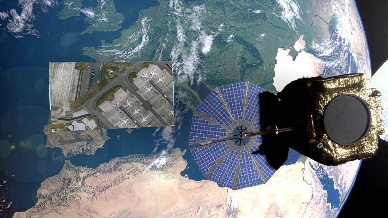
The goal is for OneAtlas to remain a powerful and intuitive gateway to Airbus satellite capabilities throughout the Pléiades Neo Next era.
Airbus Defence and Space
Australia, Brazil, China, Finland, France, Germany, Hungary, Singapore, Spain, United Kingdom, United States
This document is not contractual. Subject to change without notice. © Airbus DS 1986 – 2026 | Pléiades © CNES 2019, Distribution Airbus DS. Radar Constellation © DLR e.V. 2019-2024, Distribution Airbus Defence and Space GmbH. All rights reserved.