Latest News
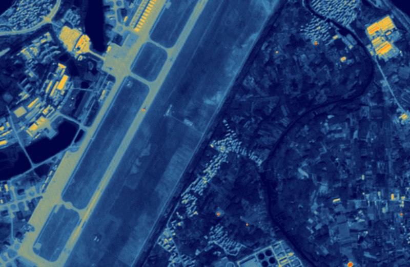
SatVu thermal imagery of the Quzhou airfield in Zhejiang Province, China. Photo: SatVu
SatVu will support the National Geospatial-Intelligence Agency’s (NGA) Luno A & B programs by partnering with five other companies to provide its thermal imagery.
SatVu, based in the United Kingdom, collects high-resolution thermal imaging from space. The company said June 19 it will provide and integrate its state-of-the-art thermal imagery with the other imaging capabilities offered by its teammates and prime contractors.
The NGA procures commercial imagery and data services under the Luno A and B programs global economic, environmental, and military activity. NGA selected 10 vendors for Luno A in September 2024, and 13 companies for Luno B in January of this year. All 10 of the companies on the Luno A contract are also on the Luno B contract.
SatVu did not specify its five partners.
“Our collaboration with industry leaders reflects a shared commitment to advancing geospatial intelligence for national security and global resilience. By integrating SatVu’s high-resolution thermal imagery with cutting-edge data and analytics, we’re delivering a new activity layer to support mission-critical decision-making in the NGA’s Luno B program,” commented SatVu CEO Anthony Baker.
Stay connected and get ahead with the leading source of industry intel!
Subscribe Now