
Imagery and Sensing
-
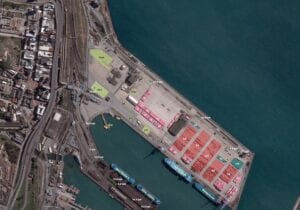
 Sustainability
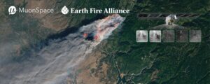
Muon Space and Earth Fire Alliance Plan FireSat Constellation to Target Wildfires
Muon Space and Earth Fire Alliance are working together to build a new satellite constellation to aid in global wildfire response, called the FireSat Constellation. The initiative has the expertise […]
-
 Government/Military
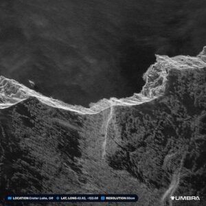
DARPA Selects Northrop Grumman, Umbra for Phase II of DRIFT Program
Northrop Grumman and Umbra have been awarded small contracts by the Defense Advanced Research Projects Agency (DARPA) to continue to the second phase of a program designed to collect data from radar-equipped […]
-
 Imagery and Sensing
Kuva Space Wins New ESA Deal
Kuva Space has won a new contract from the European Space Agency (ESA) worth 1.8 million euros ($1.9 million) as it looks to build its business in Europe. As a […]
-
 Imagery and Sensing
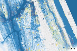
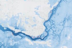
Iceye Launches New Flood Insights Products in Canada
Iceye launched its Flood Insights and Flood Early Warning products to provide flood data to Canada. Satellite data provider Iceye, launched the products on May 2. “By providing access to […]
-
 Imagery and Sensing
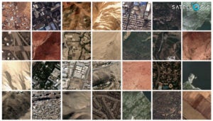
Satellogic Releases Open Dataset to Train AI Models
Satellite imagery company Satellogic released a large dataset of high-resolution imagery to train foundational Earth observation (EO) AI models. Satellogic announced Wednesday it released the full dataset on Hugging Face […]
-
 Imagery and Sensing
Unseenlabs Unveils Plan to Launch New Satellite Constellation to Monitor Sea, Land, and Space
Unseenlabs aims to launch a new surveillance constellation in 2026. The France-based maritime surveillance company that specializes in radio frequency (RF) detection will expand its fleet to include monitoring terrestrial […]
-
 Imagery and Sensing
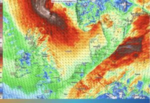
Spire Global Enters Deal with Financial Firm for Weather Forecasts
Spire Global has entered a multi-million-dollar deal with an unnamed financial firm to provide its High-Resolution Weather Forecast model. This model offers a six-day outlook powered by space data and […]
-
 Imagery and Sensing
Iceye Signs Flood and Wildfire Data Collaboration Deal With Juniper Re
Finnish satellite company Iceye has a new data collaboration with reinsurance broking arm Juniper Re for Iceye’s Flood and Wildfire Insights data. Iceye announced the new, multi-year agreement on April […]
-
 Sustainability
Satellogic Partners With O.N.E. Amazon to Build the ‘Internet of Forests’
Satellogic, a Earth observation data collection company, signed a letter of intent with O.N.E. Amazon to support the creation of an initiative called the ‘Internet of Forests.’ O.N.E. Amazon is […]
-
 Imagery and Sensing
Satellogic is Relocating to the US, Announces Crypto Investment in 2023 Results
Earth imagery provider Satellogic has begun the process of relocating the company to the U.S., and recently received a $30 million strategic investment from cryptocurrency company Tether Investments Limited. Satellogic […]
-
 Finance
Iceye Raises $93M, Led by Finnish Sovereign Wealth Fund Solidium
Finnish satellite company Iceye raised $93 million in growth funding, led by Finland’s sovereign wealth fund Solidium. Other investors include Move Capital Fund I, Blackwells Capital, Christo Georgiev, and existing […]
-
 Imagery and Sensing
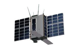
Muon Space Wins Over $60M in Contracts for Muon Halo 10-Satellite Constellation
Muon Space wins over $60 million in new customer contracts for the release of the planned Low-Earth Orbit (LEO) Muon Halo 10 smallsat constellation. Muon Halo’s integrated hardware and software […]
-
 Manufacturing
Hancom Inspace Chooses Spire Global to Build Imaging Constellation
Spire Global set an agreement with Korean company Hancom InSpace to enhance its Sejong-1 satellite and to build and operate two additional satellites, Sejong-2 and Sejong-3. The company said that […]
-
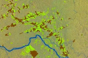
 Sustainability
Exploring New Opportunities to Leverage Earth Observation Data for Sustainability
Earth observation satellites are critical assets for deriving insights into everything from deforestation to natural disasters – and the need for the insights they deliver has never been greater. There […]
-
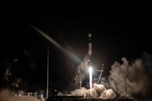 Imagery and Sensing
Rocket Lab Launches New Satellite for Synspective’s SAR Constellation
Rocket Lab launched the fourth satellite for Japanese synthetic aperture radar (SAR) company Synspective. Rocket Lab launched the mission on an Electron rocket from Launch Complex 1 in New Zealand […]
-
 Imagery and Sensing
Planet Wins Contract from Naval Information Warfare Center for Vessel Detection
Planet Labs Federal, a subsidiary of Planet Labs, was awarded a contract by the Naval Information Warfare Center (NIWC) Pacific for vessel detection and monitoring over key areas in the […]
-
 Finance
Nuview Acquires Astræa to Execute Global Data Superhighway Strategy
Earth observation and geospatial technology company Nuview, acquired software service platform Astræa Tuesday. Nuview plans to use Astræa’s AI-driven distribution and analysis tools to develop a high-throughput Earth observation […]
-
 Imagery and Sensing
Kuva Space Details Plan to Target US Government Business in Expansion
Finnish hyperspectral startup Kuva Space is working to break into the U.S. market, recently hiring former Iceye US CEO Jerry Welsh to lead the company’s expansion in the U.S. The company […]
-
 Imagery and Sensing
Synspective to Contribute to Natural Disaster Preparedness in Vietnam
Synspective is teaming up with the National Remote Sensing Department of the Ministry of Natural Resources and Environment of Vietnam and Fujitsu Vietnam to help with natural disaster preparedness, natural resource […]
-
 Government/Military
BlackSky CEO Details Sovereign Deal with Indonesian MoD
BlackSky Technology shared more details this week about a recent $50 million deal to supply subscription imagery and analytics to the Indonesian Ministry of Defense (MoD). In this deal, the […]
-
Imagery and Sensing
NASA Launches PACE Satellite in New Climate Mission to Study the Ocean and Atmosphere
SpaceX launched NASA’s satellite mission to study ocean health, air quality, and the effects of climate change into orbit early Thursday morning. After being rescheduled twice due to weather conditions, […]
-
 Imagery and Sensing
BlackSky Advances to Third Phase of SMART Program for AI Tools
BlackSky Technology won a contract from the Intelligence Advanced Research Projects Activity (IARPA) for the third phase of the Space-based Machine Automated Recognition Technique (SMART) program. BlackSky has won previous […]
-
Imagery and Sensing
Synspective Signs New SAR Contracts in Central Asia
Synspective is increasing its reach into key Central Asian markets. The Japanese SAR satellite data and analytics solution provider has entered into MoUs with Uzbekistan’s Center for Space Monitoring and […]
-
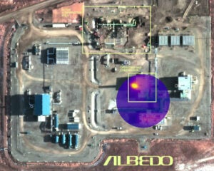 Finance
Albedo Raises $35M With Booz Allen Investment
Albedo raised a $35 million Series A-1 financing round announced on Tuesday, to launch the company’s first operational satellite to collect ultra-high resolution imagery. These funds bring Albedo’s total funding […]
-
 Imagery and Sensing
Viasat Reveals Details of Satellite Navigation Demonstration in UK
Viasat has revealed details of a key demonstration in the United Kingdom in the aviation arena. It has demonstrated a U.K. satellite-based augmentation system (UK SBAS) for the first time, […]
-
 Government/Military
NGA Issues Solicitation for New, $290M Economic Indicator Monitoring Contract LUNO
Due to significant demand under an existing contract for geospatial-intelligence (GEOINT) data to analyze visible economic indicators, the National Geospatial-Intelligence Agency (NGA) plans to award a new contract for commercial […]
-
 Government/Military
Muon Space Wins AFWERX Contract Focused on Weather ISR
Muon Space has received a small business innovation research (SBIR) contract from AFWERX focused on weather intelligence, surveillance and reconnaissance (ISR) and operational mission planning. AFWERX is the innovation arm of […]
-
 Imagery and Sensing
New ESA Environmental Security Project Goes Live
A new European Space Agency (ESA) project to fight environmental crime and monitor illegal activities is now fully operational. The project, EO4Security, is dedicated to developing algorithms and application platforms […]
-
 Launch
Rocket Lab to Launch NorthStar and Spire SSA Mission This Month
A group of four space situational awareness satellites for Spire Global and NorthStar Earth & Space will be Rocket Lab’s first launch of 2024. Rocket Lab announced Monday it plans […]
-
 Imagery and Sensing
NOAA Awards Spire Global $9.4M Radio Occultation Data Buy
The National Oceanographic and Oceanic Administration (NOAA) awarded Spire Global a $9.4 million data buy for radio occultation (RO) data for an 8-month period. This award is part of NOAA’s […]