Harris Corp. purchased non-exclusive rights to Earthstar Geographics LLC‘s Terracolor satellite imagery product, Earthstar announced.
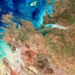
The products simulates true color satellite imagery at 15-meter resolution. Applications include location-based mapping, land use and vegetation analysis, 3-D visualization and cartographic mapping.
“When we decided to offer an enhanced 15-meter world dataset for the visualization and simulation market, we evaluated building a new custom dataset or leveraging an archived product,” Tom Kubancik, business development for Harris Imagelinks, said in a statement. “We chose Terracolor as the highest quality off-the-shelf product that still allowed us the ability to customize to meet the needs of our customers.”
Financial details of the agreement were not released.