Latest News

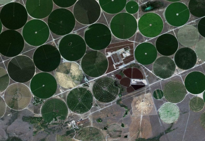
Circular fields in Morrow County, Oregon. Photo: Planet.
Farmers Edge announced a strategic partnership to bring Planet’s global monitoring data and platform capabilities to the Farmers Edge precision agriculture product suite. Farmers Edge is now a sole distributor for Planet in key agricultural regions, with the right to use and distribute high-resolution, high-frequency imagery from Planet’s three flagship satellite constellations.
Through this multimillion-dollar, multi-year global distribution agreement, Farmers Edge and Planet are significantly expanding their existing partnership. The companies will deliver a range of remote sensing driven and analytics-based agronomy services to growers worldwide. According to Farmers Edge, while traditional imagery products provide only a partial, delayed, or inconsistent view of fields, this partnership equips Farmers Edge growers with high-quality field imagery that is more frequently updated.
The combination of Planet’s data set and Farmers Edge image processing technology allows for early crop monitoring and gives growers an opportunity to correct factors that could limit crop performance and compromise yield potential. Growers will now have access to field-centric data updated throughout the growing season, including early monitoring of crop stand, detection of pest and weed pressure, drainage issues, hail damage, herbicide injuries, nutrient deficiencies, yield prediction, and more.
The combination of Planet’s data set and Farmers Edge image processing technology allows for early crop monitoring and gives growers the opportunity to correct factors that could limit crop performance and compromise yield potential. Growers will have a wealth of field-centric data updated throughout the growing season, including early monitoring of crop stand, detection of pest and weed pressure, drainage issues, hail damage, herbicide injuries, nutrient deficiencies, yield prediction and more.
“Until now, the challenge with satellite imagery was the data was simply not frequent enough to react to crop stress in a timely manner,” said Wade Barnes, president and Chief Executive Officer (CEO) of Farmers Edge. “At Farmers Edge, providing our customers with the most concise, comprehensive, and consistent data is at the core of what we do. We understand the need for more image frequency, that’s why we are partnering with Planet. Daily imagery is a game-changer in the digital ag space.”
Get the latest Via Satellite news!
Subscribe Now