
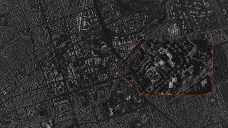
[Via Satellite 12-31-2014] The country of China has been entirely mapped in High Definition (HD) by satellite, according to the Chinese National Administration of Surveying, Mapping and Geoinformation. China began photographing the country at a level that can clearly image objects smaller than one meter by satellite in 2012. As of 2014, the compiled imagery covered the entire land territory of the country.
China Completes High Definition Map of Entire Country
By  Caleb Henry
Caleb Henry


AiRanaculus to Advance Networking Technologies for NASA Lunar and Space Communications Networks
Networking technology company AiRanaculus has received a $5 million award from NASA for its technologies to be used to support NASA lunar and space communications networks. Under a $5 million […]


Trending Now
-
 Government/Military
NATO Allies Plan Hybrid HALO Constellation
-
 Government/Military
L3Harris and Sierra Space Receive $1.75B for SDA Tranche 3, Tracking Layer


