Latest News
Vantor Introduces New Satellite Classes for High Resolution Imaging, Frequent Revisits
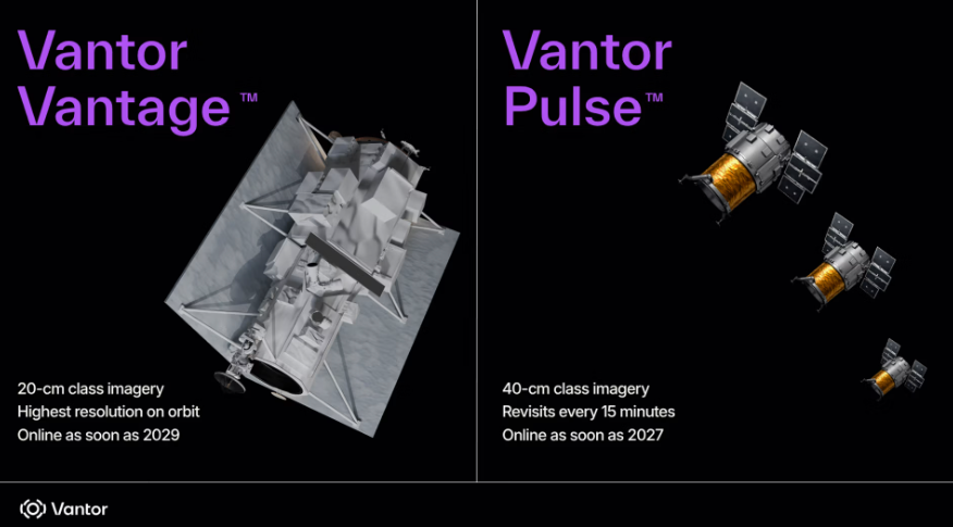
Renderings of new Vantor Vantage and Vantor Pulse satellites. Photo: Vantor
Commercial satellite operator and spatial intelligence provider Vantor on Thursday introduced two new classes of electro-optical imaging satellites that packaged together offer its customers high-resolution imagery and frequent revisit rates around the globe in a single platform.
Vantor Pulse, the company’s entrée into the small satellite market, will consist of a fleet of more than 10 40-centimeter-class resolution satellites that can revisit the same location on Earth every 15 minutes, Colorado-based Vantor said.
The first Pulse satellites are expected to be online in 2027.
Vantor Vantage, which is based on a larger satellite bus, features 20-centimeter-class resolution, which Vantor says will be “the highest commercial resolution on orbit.” The company plans to have the first two Vantage satellites on orbit as early as 2029.
The frequent revisit rate of Pulse will provide tipping and cueing for the higher-end Vantage satellites, a combination of capabilities that customers typically rely on multiple imagery providers to accomplish, Dan Smoot, Vantor’s CEO, told Defense Daily on Wednesday.
One of Smoot’s observations from the ongoing war in Ukraine and U.S. operations against Iran has been the value of highly accurate geospatial intelligence for uses such as landscape navigation and identification.
“And the good news is, where we’ve had those exquisite capabilities, we’re seeing high rate of success,” he said. “Where customers have learned lessons is you can’t just do things on just revisit and not having that clarity, because you need that clarity to be able to enable successful missions.”
The combination of a high revisit rate and high-resolution data means “we’re going to be able to speed up mission success at an exponential rate that … customers in the past had to go to multiple providers to obtain that type of information,” Smoot said.
Vantor currently operates the WorldView constellation of electro-optical imaging satellites, which include the new Legion spacecraft that provide 30-centimeter-class resolution and revisit the same area on Earth up to 15 times per day.
The company is taking lessons from its “exquisite” satellites and applying them to the new Pulse-class to “have some really strong capabilities at 40-centimeters that will give us a tip and cue in a single system that nobody has been able to do by having both those types of capabilities,” Smoot said, referring to Pulse and Vantage.
The satellites will feed into the company’s Tensorglobe geospatial intelligence platform that customers purchase to have sovereign capabilities, giving them continuously updated data and accurate intelligence.
“So, it’s the first time governments and businesses will be able to get image quality and speed under a single commercial system,” Smoot said. “Historically, you had to buy it from two different providers, and now you’ll be able to do it under one operating system.”
Tensorglobe also brings in data from the WorldView constellation, creating a single platform for all the company’s data, he said.
Stay connected and get ahead with the leading source of industry intel!
Subscribe Now