Latest News
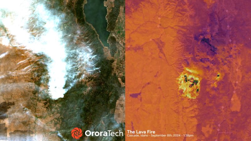
OroraTech thermal imagery (right) of the Lava Fire in Idaho in 2024. Photo: OroraTech
The Idaho Department of Lands will deploy a statewide satellite-based wildfire detection and monitoring system through a new partnership with OroraTech USA.
OroraTech said Sept. 10 that the system uses both public and its own proprietary wildfire satellites and other public data sources. It is designed to provide fire location, intensity, and predicted spread. The company said this information can be shared with dispatch centers and firefighters within minutes.
The Idaho Department of Lands Fire Management (IDL Fire), along with its partners and rural volunteer fire departments, is responsible for fire suppression and prevention on more than 9 million acres of state, private, and federal land in Idaho.
“By partnering with the Idaho Department of Lands, we’re ensuring that firefighters across the state have access to the most advanced wildfire intelligence available,” said Thomas Gruebler, CEO of OroraTech USA. “With the ability to detect wildfire ignitions that are the size of a small automobile, we are giving Idaho’s first responders every possible advantage in protecting lives, property, and the land that defines this great state.”
OroraTech is a German startup that expanded to the U.S. this year. The company operates a constellation of thermal imaging satellites and added eight new satellites this past March.
Stay connected and get ahead with the leading source of industry intel!
Subscribe Now