Latest News
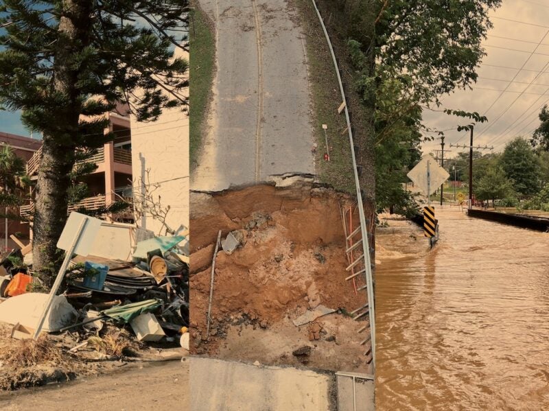
Damage caused by Hurricane Helene in Florida, North Carolina, and South Carolina. Via Satellite archive illustration. Photos via Shutterstock
The Satellite Industry Association is encouraging policy and lawmakers to look to satellite communications and technology to assist in natural disaster response. SIA, which represents satellite operators, manufacturers, equipment suppliers, and others, issued a new report this week on the services satellites can provide both before and after an emergency,
“Satellites have been providing emergency communications and remote sensing data for decades, and now thanks to recent leaps in innovation, advanced multi-spectral imaging and direct to device emergency communications services are now available, providing even more critical services before, during and after a disaster,” SIA president Tom Stroup said.
Stroup encouraged government planners, relief agencies, private enterprise and consumers to consider the “reliability and ubiquity of satellite services” in disaster planning.
The report provides a backgrounder on how satellite technology plays a role in disaster response, including how government-owned satellites like NOAA’s GOES-R series provide forecasters with sharper images of severe storms; how commercial radio occultation data provides additional atmospheric data; and how satellite communications are deployed in disaster response when networks are down.
It details specific initiatives where satellite companies have worked with government and commercial partners to assist in disaster response, like Hughes Network Systems working with FirstResponse1 after Hurricane Maria in Puerto Rico to establish emergency connectivity with VSAT equipment, and how UltiSat deployed Low-Earth Orbit (LEO) satcom to government agencies after Hurricane Helene hit the Southeast last year.
Stay connected and get ahead with the leading source of industry intel!
Subscribe Now