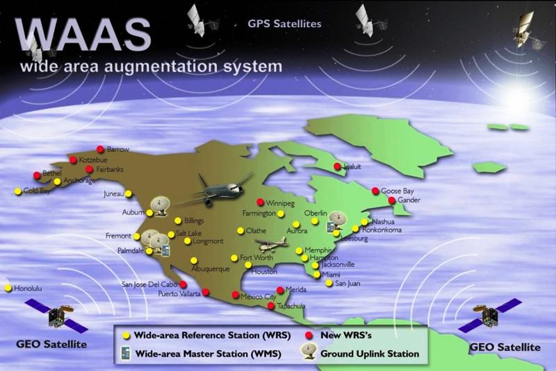
Raytheon delivered the Wide Area Augmentation System (WAAS) Geosynchronous Earth Orbiting (GEO) 6 satellite navigation payload to the Federal Aviation Administration (FAA) to broadcast the WAAS message, which corrects errors in GPS satellite signals, provides expanded coverage, improves accuracy, and increases reliability. The WAAS GEO 6 payload is now operational and fully integrated into the WAAS network, working with two other WAAS satellite payloads already in orbit.
Developed and installed by Raytheon for the FAA, WAAS is a North American satellite-based augmentation system that increases GPS satellite signal accuracy for precision approach at 200 feet altitude to meet strict air navigation performance and safety requirements for all classes of aircraft in all phases of flight.
“Never has a consistent and precise GPS signal been more critical to ensuring safety of flight,” said Matt Gilligan, vice president of Raytheon’s Intelligence, Information and Services business. “As the airspace increases in complexity, there is absolutely no room for error.”