Kratos, HawkEye 360 Collaborate on Spectrum Detection, Geolocation Services

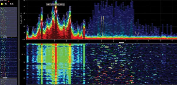
Hawkeye 360 spectrum mapping. Photo: Hawkeye 360.
Kratos Defense & Security Solutions and HawkEye 360 have signed a Memorandum of Understanding (MOU) to explore the potential of expanding Kratos’ carrier monitoring, interference detection and geolocation offerings with HawkEye 360’s planned space-based Radio Frequency (RF) detection and geolocation services. According to the two companies, the combination of space and terrestrial sensors will benefit customers by increasing the speed and accuracy of data analysis for industries such as broadcasting, transportation, military, public sector, manufacturing, and emergency response.
Included in Kratos’ portfolio of enterprise-grade ground segment products and solutions is its global RF network that helps commercial and government satellite operators assure satellite and payload performance with carrier monitoring, interference detection, geolocation and data analytic services. Kratos is expanding its infrastructure with seven new worldwide monitoring sites — including High-Throughput Satellite (HTS) spot beam and Very Small Aperture Terminal (VSAT) monitoring — hosting more than 60 antennas and providing visibility to more than 50 satellites, 100 beams and 200 transponders.
HawkEye 360 plans to build a constellation in Low Earth Orbit (LEO), the first launch of which is scheduled for early 2018, with the complete RF survey and geolocation constellation scheduled to be on orbit by 2020. HawkEye 360’s system will monitor RF spectrum usage to help identify areas of interference, better understand spectrum deployment, and avoid negative impact to operations. The system could also help to detect and locate activated emergency beacons to improve response times in life-threatening situations, according to the company.