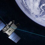
A constellation of Space Radar satellites with capabilities such as spotting moving targets on the ground would be technologically feasible by 2015, and likely would cost $25 billion to $90 billion, most likely in a range of $35 billion to $50 billion-plus, a new Congressional Budget Office (CBO) study finds.
But developing the new technology would be challenging, according to the CBO. And the finished system wouldn’t be able to perform some tasks such as continuously tracking and following moving targets.
Space Radar would be developed by the Air Force, National Reconnaissance Office, and National Geospatial-Intelligence Agency.
Those cost estimates for Space Radar are so broad because the price would depend heavily on factors such as the size of the radar on each Space Radar satellite, and on the number of satellites launched for the constellation.
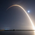
Space Radar would produce images of the Earth’s surface using synthetic aperture radar (SAR) techniques and would detect moving targets on the ground, among other missions, with a first launch seen in 2015, the nonpartisan CBO noted.
To be able to identify moving targets on the ground from a position in space would be no small feat, according to the report.
The “ability to identify moving targets from space would constitute a major improvement in capability,” CBO observed, but that “would require designers to meet numerous technical challenges.”
CBO outlined the challenge this way: from perhaps hundreds of miles up, the Space Radar platform would have to discern between fixed objects on Earth that appear to the satellite to be moving at 15,000 miles per hour, and targets on Earth moving perhaps just a few miles an hour more or less than that.
This won’t be easy, the CBO warned.
“Arguably, the most critical technical challenge facing the Space Radar program is the development of dataprocessing algorithms that can distinguish between moving targets and the background clutter around them,” the report noted.
“Identifying such targets from space is especially hard: from the point of view of an orbiting satellite, the ground is moving at about 15,000 miles per hour, so distinguishing a vehicle that is moving only a few miles per hour faster than that is a difficult task.”
On top of the daunting hurdles of developing the technologies needed for such a system would be the difficult task of turning concepts into metal, the report continued.
“Production of the Space Radar satellites would also require that various hardware challenges be met,” the CBO noted. “Those challenges would include developing a large phased- array radar antenna that could survive launch and deployment in space; improving the efficiency of batteries that operate in space; and developing signal-processing systems, satellite-to-ground communications, and intelligence exploitation systems that could handle the large flow of raw data and resulting intelligence products that a Space Radar satellite would generate,” the watchdog agency observed.
These are still early days for the Space Radar program.
The Air Force and its partners have not yet decided on final design of the satellites or the final architecture of the constellation.
So CBO examined four possible Space Radar systems that might be procured from contractors, any of which could meet principal mission objectives.
“Those architectures were based on unclassified published studies and were designed to be technologically feasible (albeit challenging) in 2015, the anticipated year of the first launch,” CBO noted.
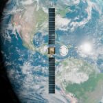
Specifically, the primary — or reference — architecture consists of nine satellites, each with a 40-square-meter radar array, the CBO noted.
The agency created the other possible Space Radar system concepts by setting forth one that would have more satellites, a total of 21, or fewer, a total of five sats, compared to the reference system. Or, the CBO varied the reference system by proposing one that would have larger radars, 100-square-meter arrays on nine satellites.
CBO analysis of all this suggests that developing a Space Radar system is doable.
“Analysis of those architectures suggests that the Space Radar system should be able to produce large amounts of high-resolution SAR imagery with only modest advances in technology, even in the case of the smallest constellation that would have just five satellites,” the study found.
To be sure, however, the Space Radar systems concepts that GAO evaluated would have limitations.
For example, “the constellations that CBO considered would not be able to provide continuous SAR coverage of a region,” since satellites to remain in orbit must continuously move ahead at thousands of miles per hour.
But Space Radar coverage would be better than what the United States has today.
The “response time — how soon they could produce images of an area after receiving an order to do so — should offer an improvement over existing capabilities,” the GAO predicted.
“For imagery with a resolution of 1 meter, average response times would range from about 45 minutes for the five-satellite constellation to less than 7 minutes for the 21- satellite constellation,” the GAO explained.
To be able to spot moving targets on the ground, Space Radar arrays and signal processing algorithms would have to perform about as well as could be hoped, according to the watchdog agency.
Space Radar moving target sensing “would prove more challenging,” CBO predicted. For satellite systems “with 40-square-meter radar arrays, signal-processing algorithms would need to perform near their theoretical optimum level for Space Radar to be able to detect targets moving more slowly than about 20 miles per hour.”
But a bigger radar array would lessen the risk that the system wouldn’t perform as needed, according to the GAO.
“Using a larger radar array, such as the 100-square-meter design that CBO examined, would reduce the level of signal processing performance needed to detect slow-moving targets,” the report found.
Even with optimal signal-processing performance (or larger-aperture radars), substantial time gaps in covering a given area would probably occur for all of the constellations CBO considered.
Any of the systems CBO contemplated “would be impractical for tracking (as opposed to simply detecting) individual ground targets,” the report cautioned.
“If other surveillance systems were not available to augment Space Radar — for example, because a lack of access to airspace prevented the use of surveillance aircraft — constellations larger than the ones that CBO examined would be necessary to track individual ground targets,” the agency explained.
But one of the key selling points of a Space Radar system is that it would be able to spy on enemy movements in areas where U.S. access is denied.
In estimating that a Space Radar system might cost anywhere from $25 billion, in 2007 dollars, to $90 billion, the CBO stated those figures would include research and development, procurement of the satellites and associated ground systems, satellite launches, and operations over the expected 20-year lifetime of the Space Radar system.
The nine-satellites system with radar arrays of 40 square meters each would cost about $35 billion to more than $50 billion, according to the report.
If one cuts the number of satellites from nine to five, that would lower total costs by about 25 percent, the report stated.
Conversely, increasing capability by using either larger radar arrays or more satellites would add between 50 percent to 90 percent to the total costs.
A Space Radar program of $25 billion to $90 billion is attracting contractor interest. For example, Northrop Grumman [NOC], the third-largest defense contractor, leads an industrial team to develop Space Radar concepts and perform risk mitigation on one of two competing Phase A contract efforts. Northrop team members are Boeing [BA], Raytheon [RTN], General Dynamics [GD], and BAE Systems.
That team is opposing competitor Lockheed Martin [LMT].
The 90-pages CBO report entitled “Alternatives for Military Space Radar” can be viewed in entirety at http://www.gao.gov on the Web. The report was prepared for Sens. Wayne Allard (R-Colo.), and Bill Nelson (D-Fla).