SSTL to Launch GNSS-Reflectometry Ocean Wind Data Service
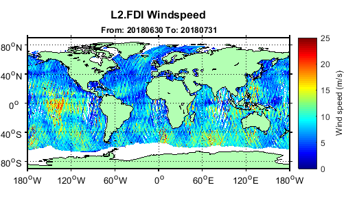
Measurement of Earth Reflected Radio-Navigation Signals by Satellite’s (MERRBYS) July map of wind speed over the oceans. Source: MERRBYS
Surrey Satellite Technology (SSTL) and the National Oceanography Center (NOC) launched the first Global Navigation Satellite Systems (GNSS)- Reflectometry ocean wind data service that is global, with support from the European Space Agency (ESA).
The data service is free and is hosted on Earth Reflected Radio-Navigation Signals by Satellite’s (MERRBYS) website, where users can access measurements of wind taken by a specially designed GNSS receiver hosted on SSTL’s TechDemoSat-1 satellite, which collects GNSS signals reflected off the surface of the ocean. TechDemoSat-1 also collected GNSS reflections off land and polar regions, opening the door for new applications of this technology, such as soil moisture and ice measurements.
The current service is a pilot demonstration showing the potential for a new source of wind and wave measurements from in-orbit, using a small satellite. In the future, a constellation of low-cost small satellites carrying enhanced instruments could provide measurements in near-real time to support weather and wave forecasting.