Esri Users to Receive Sentinel-2 Image Services For Free
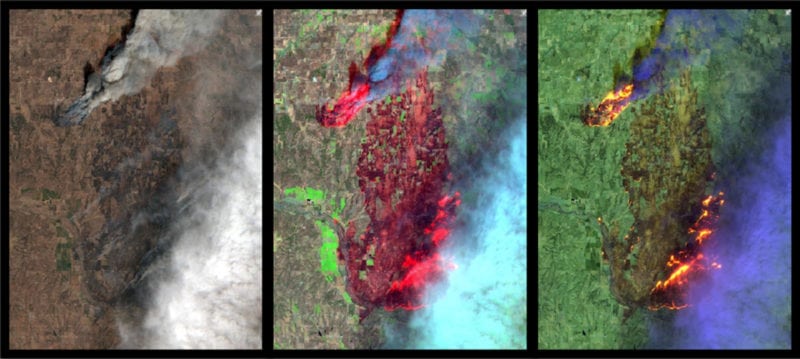
Multi-spectral imagery from the Sentinel-2 image services. Photo Credit: Esri
Esri, a provider of spatial analytics, has announced that it is releasing Sentinel-2 image services to all Esri users for no additional cost. Sentinel-2 is an Earth observation satellite that provides multi-spectral imagery for any location in the world at 10m resolution.
Currently in beta, the service is updated daily with new imagery for all ground locations every five to seven days. Sentinel-2 image services provide temporal, multi-spectral imagery of the entire globe for improved monitoring of agricultural and forest conditions, monitoring of land cover changes, and to assist with natural disaster management.
Sentinel-2 is part of Copernicus, the Earth observation program directed by the European Commission in partnership with the European Space Agency (ESA). Esri makes the multi-spectral data accessible using ArcGIS Image Server and publishes an image service through the ArcGIS Living Atlas of the World. The service includes all Sentinel-2 imagery going back 14 months, enabling change to be easily reviewed. Image analysis can be run directly on the service to create indexes displaying properties such as vegetation health or soil moisture as well as quantifying the changes over time, for better understanding of the environment.