DigitalGlobe: More Imagery Available, New Rapid Access Program
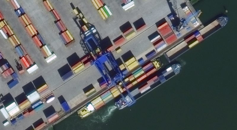
A 30cm image of the Port of Rotterdam. Photo Credit: DigitalGlobe
DigitalGlobe, a Maxar Technologies company, has announced that with the complete integration of its WorldView-4 satellite imagery into SecureWatch, the company’s cloud-based Geospatial Intelligence (GEOINT) platform, customers can now access more of the company’s highest resolution satellite imagery. WorldView-4’s daily imagery collections more than double SecureWatch’s daily volume of 30 cm imagery, enhancing defense and intelligence analysts’ ability to closely monitor activity in their areas of interest, according to the company.
The subscription-based platform will expand further this year when Radarsat-2 imagery from MacDonald Dettwiler and Associates (MDA), another Maxar company, becomes available. MDA’s Radarsat-2 Synthetic Aperture Radar (SAR) imagery will expand the capacity for analysts to monitor key locations around the world, regardless of weather and light conditions.
In order to provide customers with fast, priority access, DigitalGlobe has also launched its Rapid Access Program. This secure cloud-based platform is designed to give customers the flexible and efficient imagery collection they want, over their region of interest, with the highest available priority level on the DigitalGlobe constellation, meaning collections submitted against assigned satellite access times are assured.
Customers log in through an online portal where they can develop collection plans with DigitalGlobe’s five high-resolution satellites. The platform’s interface for planning and collection optimization, developed by DigitalGlobe partner Orbit Logic, allows customers the flexibility to modify collection targets up to 90 minutes prior to image acquisition.