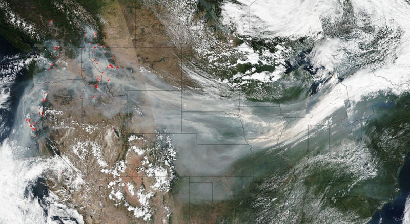
As the southern United States recovers from two monstrous back-to-back hurricanes, states in the Pacific Northwest continue to battle ash and smoke drifting from wildfires raging nearby. Almost 1.5 million acres are currently ablaze in the region — and the U.S. Forest Service, a small, arguably underfunded agency, is seeking more efficient ways to monitor and respond to such large-scale events. Could optical satellites be the solution?
US Forest Service Turns to Satellite to Monitor Wildfires





Political Paralysis Cannot Be Allowed to Undermine America’s Strategic Edge in Space
The U.S. midterms have dramatically shifted the balance of power in Washington. With Democrats taking control of Congress, President Trump now faces a legislature with both the power and appetite […]




Trending Now
-
 Government/Military
Ukraine Reports More Restrictions to Starshield Access