Mapbox Tracks California Wildfires with DigitalGlobe Imagery
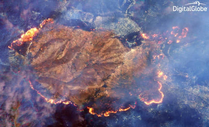
DigitalGlobe uses a Shortwave Infrared (SWIR) sensor built by Harris on its WorldView 3 satellite to penetrate the smoke and detect heat beneath. Photo: DigitalGlobe.
Mapbox has published a new map to give people affected by the wildfires in Northern California and across the United States access to the up-to-date information on fire perimeters in relation to specific locations and addresses.
Using data coming from the Geospatial Multi-Agency Coordination project and from the agencies and first responders on the ground, this map allows anyone to search a specific address to see where it falls in relation to the fire perimeters for wildfires burning across the United States.
Coupled with satellite imagery from DigitalGlobe, this tool can provide valuable information to help those affected by fires get information about their family, friends, homes, and businesses. DigitalGlobe released the satellite imagery as part of its Open Data Program, over which Mapbox has laid its own data.