Ursa Analyzes SAR Imagery to Monitor Hurricane Harvey Flooding
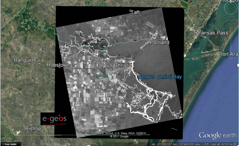
Radar imagery of the hurricane impact in Corpus Christi, TX. Photo: Ursa Space Systems.
Ursa Space System, with support of satellite images furnished by e-Geos, a subsidiary of the Italian Space Agency (ASI) and Telespazio, is monitoring areas affected by Hurricane Harvey in Texas. Due to the heavy cloud cover from the hurricane, optical satellites are unable to penetrate the areas to capture information about ground conditions. It is also difficult for airborne sensors to obtain information, due to the high wind conditions. Ursa is analyzing satellite-based Synthetic Aperture Radar (SAR), which can get information through cloud cover or at night, to get insight into the extent of flooding.
Through Ursa’s agreement with e-Geos, e-Geos is monitoring Hurricane Harvey and providing images from the Italian constellation, Cosmo-SkyMed, of radar satellites.
For the near term, Ursa will continue to monitor areas along the Texas Gulf Coast where there is predicted flooding, including the Corpus Christi area as shown in the image above.