Spaceflight Industries Unveils New Imagery Service, Airbus Satellites Added
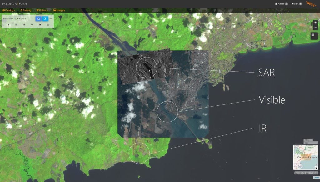
Image from BlackSky Spectra, displaying visible, SAR, and IR data over Panama City and the Miraflores Locks. (Images from Airbus Pléiades, Airbus TerraSAR-X, and USGS Landsat; some of the bans are IR, some are visible), respectively.
Spaceflight Industries has revealed BlackSky Spectra, its on-demand satellite imagery service which enables customers to discover archive images and task new images from 13 high-resolution imaging spacecraft through a web platform. BlackSky Spectra enables customers to look at the planet across every spectrum, from visual imagery to multi-spectral data including Synthetic Aperture Radar (SAR), hyperspectral data, and radio frequency detection, which provides a more comprehensive view of the world, according to the company. Users can also directly task these satellites by selecting a specific location on a map and indicating how often they want a picture taken.
In addition, the company announced Airbus’s Pléiades, SPOT6/7, KazEOSat 1, and TerraSAR-X are the latest sensors to join the BlackSky network. Other spacecraft include 21AT’s TripleSat, SIIS’s KOMPSAT2/3/3A/5, and UrtheCast’s Deimos 2. The addition of Airbus sensors to BlackSky Spectra significantly increases the high-resolution tasking capacity and archive content available to users. Together, this ecosystem represents the largest network of high-resolution sensors accessible from an online catalog, according to Spaceflight Industries.