US Forest Service Turns to Satellite to Monitor Wildfires
By Staff Writer | September 11, 2017
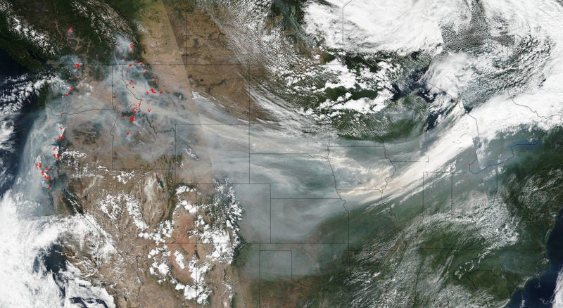
NASA’s Suomi NPP satellite collected this natural-color image of smoke crossing the U.S. on a jet stream. Actively burning areas are outlined in red. Photo: NASA, Jeff Schmaltz.
As the southern United States recovers from two monstrous back-to-back hurricanes, states in the Pacific Northwest continue to battle ash and smoke drifting from wildfires raging nearby. Almost 1.5 million acres are currently ablaze in the region — and the U.S. Forest Service, a small, arguably underfunded agency, is seeking more efficient ways to monitor and respond to such large-scale events. Could optical satellites be the solution?